Your gateway to a wide range of natural resources information and associated maps

Victorian Resources Online

Melbourne Mapsheet - Sites of Local Significance

Back to: Port Phillip & Westernport - Sites of Geological and Geomorphological Significance

Click on selected areas in the legend for more information about that particular Geological and Geomorphological site
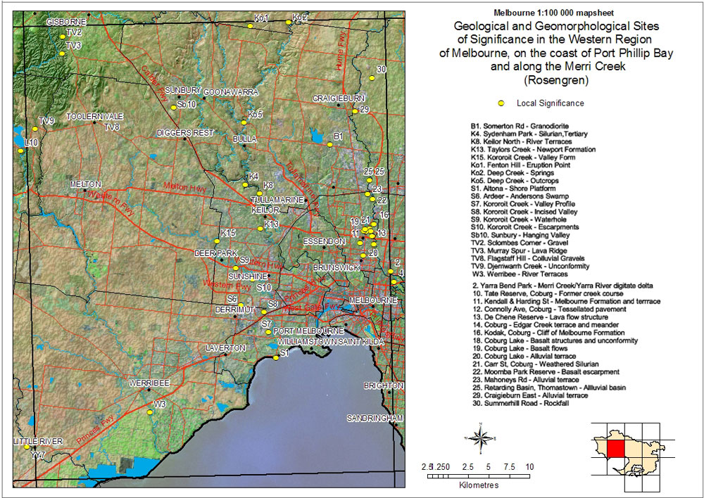
Sites of Regional local

Sites of Geological and Geomorphological Significance in the Western Region of Melbourne, on the coast of Port Phillip and along the Merri Creek

Local Significance
B1 - Somerton Rd - GranodioriteK4 - Sydenham Park - Silurian Tertiary
K8 - Keilor North - River TributariesK13 - Taylors Creek - Newport Formation
K15 - Kororoit Creek - Valley FormKo1 - Fenton Hill - Eruption Point
Ko2 - Deep Creek - SpringKo5 - Deep Creek - Outcrops
S1 - Altona - Shore PlatformS6 - Ardeer - Anderson Swamp
S7 - Kororoit Creek - Valley ProfileS8 - Kororoit Creek - Incised Valley
S9 - Kororoit Creek - WaterholeS10 - Kororoit Creek - Valley Form
Sb10 - Sunbury - Hanging ValleyTV2 - Slocombes Corner - Gravel
TV3 - Murray Spur - Lava RidgeTV8 - Flagstaff Hill - Colluvial Gravels
TV9 - Djerriwarrah Creek - UnconformityW3 - Werribee - River Terraces
2 - Yarra Bend Park - Merri Creek/Yarra River digitate delta10 - Tate Reserve, Coburg - Former crreek course
11 - Kendall & Harding St - Melbourne Formation and terrace12 - Connolly Ave, Coburg - Tesellated pavement
13 - De Chene Reserve - Lava flow structure14 - Coburg - Edgar Creek terrace and meander
16 - Kodak, Coburg - Cliff of Melbourne Formation18 - Coburg Lake - Basalt structures and unconformity
19 - Coburg Lake - Basalt flows20 - Coburg Lake - Alluvial terrace
21 - Carr Street, Coburg - Weathered Silurian22 - Moomba Park Reserve - Basalt escarpment
23 - Mahoneys Rd - Alluvial terrace25 - Retarding Basin, Thomastown - Alluvial basin
29 - Craigieburn East - Alluvial terrace30 - Summerhil Road - Rockfall
Page top