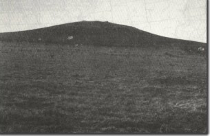
Ko1 Fenton Hill - Eruption Point
|
This information has been developed from the publications:
|
| Location | Konagaderra - 062470. Shire of Bulla. 4 km east of the Melbourne to Lancefield Road. |  Ko1 - Fenton Hill eruption point. |
Access | Fenton Hill Road | |
Ownership | Private land | |
| Site Description | Fenton Hill (373 m) is a lava mound, one of the eruption points that gave rise to the lava fields between Deep Creek and Jacksons Creek. The lava flows were short and infilled several small valleys that were tributaries to the ancestral Konagaderra Creek. As with many eruption points to the north of Melbourne, there is no crater at the summit, but lava ridges and accumulations of scoria and lava bombs indicate the final eruption centre. The hill has a distinctive shape with an abrupt steepening of slopes in the upper 100 m. | |
Significance | Local. Fenton Hill is a prominent example of the eruption points that contributed to the shaping of the landscape to the north of Melbourne. | |
| Management | To preserve the form and significant form and distinctive outcrops of the site, construction and quarrying activities should not be permitted above the 330 m contour on the southern slopes of Fenton Hill. | |
| Reference | Stewart, G. (1977). The Newer Volcanics Lava |


