Your gateway to a wide range of natural resources information and associated maps

Victorian Resources Online

Port Phillip and Westernport

Welcome to Victorian Resources Online's Port Phillip and Westernport section. This is your gateway to a wide range of resource information for the Port Phillip and Westernport catchment management region.
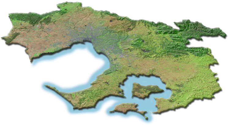
Oblique aerial overview of the Port Phillip and Westernport catchment management region showing major landform features and land use

The Port Phillip and Westernport region covers some 12,785 square kilometres - representing about 5.6 % of Victoria's total area.

Highlights

Eruption Points of the Newer Volcanic Province
Sites of Geological and Geomorphological Significance
Regional Soil/Landform Mapping


Related Sites

Local Government Authorities in Port Phillip and Westernport Region
Port Phillip and Westernport Catchment Management Authority (external link)
Page top