Your gateway to a wide range of natural resources information and associated maps

Victorian Resources Online

Geomorphological Units

Back to: Goulburn Broken Landform

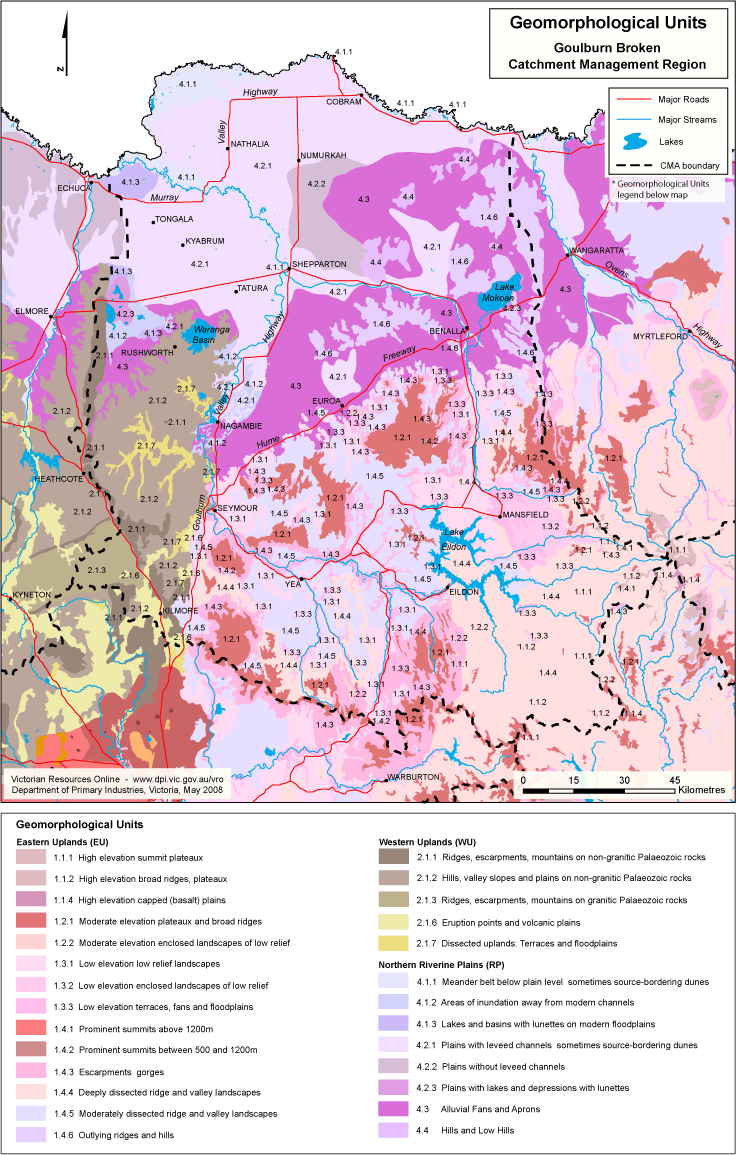
This is a clickable map. Clock on Geomorphological Unit in Legend for more information.

Goulburn Broken Geomorphological Units

Geomorphological Units
Eastern Uplands (EU)Western Uplands (WU)
1.1.1 High elevation summit plateaux2.1.1 Ridges, escarpments, mountains on non-granitic Palaeozoic rocks
1.1.2 High elevation broad ridges, plateaux2.1.2 Hills, valley slopes and plains on non-granitic Palaeozoic rocks
1.1.4 High elevation capped (basalt) plains2.1.3 Ridges, escarpments, mountains on granitic Palaeozoic rocks
1.2.1 Moderate elevation plateaux and broad ridges2.1.6 Eruption points and volcanic plains
1.2.2 Moderate elevation enclosed landscapes of low relief2.1.7 Dissected uplands: Terraces and floodplains
1.3.1 Low elevation low relief landscapes
1.3.2 Low elevation enclosed landscapes of low reliefNorthern Riverine Plains (RP)
1.3.3 Low elevation terraces, fans and floodplains4.1.1 Meander belt below plain level sometimes source-bordering dunes
1.4.1 Prominent summits above 1200 m4.1.2 Areas of inundation away from modern channels
1.4.2 Prominent summits between 500 and 1200 m4.1.3 Lakes and basins with lunettes on modern floodplains
1.4.3 Escarpments gorges4.2.1 Plains with leveed channels sometimes source-bordering dunes
1.4.4 Deeply dissected ridge and valley landscapes4.2.2 Plains without leveed channels
1.4.5 Moderately dissected ridge and valley landscapes4.2.3 Plains with lakes and depressions with lunettes
1.4.6 Outlying ridges and hills4.3 Alluvial Fans and Aprons
4.4 Hills and Low Hills
Page top