
2.1.6 Eruption points and volcanic plains (Creswick - Ballarat plains, Mt. Franklin, Mt. Blackwood, Metcalfe)
2. Western Uplands (WU)
2.1 Dissected Uplands
| The recently formed volcanic landscapes in the Western Uplands contrast with the older Cainozoic landscapes. The basalts of the Newer Volcanics fill many of the large ancient valleys to form elongate planar to undulating basalt plains which are usually fringed by streams of the displaced drainage. Occasional steep-sided gorges (e.g. Devils Kitchen, Lal Lal Falls) have developed where streams have cut into the basalt flows. The eruption points form prominent lava cones, composite cones and low shield volcanoes. The soils on both the sedimentary rocks and the granites are regarded as agriculturally ‘poor’ compared to the soils of the Newer Volcanics, which exhibit friable, clayey dark brown and red gradational soils on the younger rocks, to coarsely structured texture contrast soils on the older rocks. Undulating basalt plains within the Wimmera CMA region are confined to the upper reaches of the Mount William Creek catchment. The plains near Barton lead to vast, broad lava flows of the Western Plains. The plains have historically been cleared as part of significant pastoral runs of Western Victoria (e.g. Barton Station). | 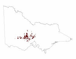 |
Lava flows filled many of the valleys east of the Moyston leaving a gently to severely undulating topography of plains, low rises (including stony) and swamps. Drainage systems of the plains are poorly developed and have been supported by a series of engineered drains to remove excess surface water for grazing and cereal cropping. The basalt plain occurs further south of the catchment divide with only a relatively minor proportion occurring in the Wimmera CMA region. The main tributary is George Creek which flows north into Mount William Creek.
These plains of Quaternary and Neogene volcanics (Newer Volcanics) have scattered stony rises and basalt ‘floaters’ in pedologically young soils. Later alluvial and aeolian sediments often overlie these basalts where displaced drainage has redeveloped as internal drainage systems with swamps (Sibley 1967). Basalt flows may have thicknesses in excess of 150 m although large areas are generally less than 20 m (Cayley & Taylor 2001). Regolith is developed to several metres depth of mottled red clay with pisoliths.
The basalt plains are known for their heavy clay soils that often result in surface ponding with many of these soils likely to have been Hydrosols prior to surface drainage. Cracking clays soils (Vertosols) with dark brown clay loam to heavy clay topsoils (slightly acidic) overlie massive bleached subsurface horizons with ferruginised nodules. A clear boundary exists to brown to yellow brown heavy clay subsoil that are neutral to alkaline. In addition to cracking clays, sodic brown, yellow and grey texture contrast soils (Sodosols) are dominant with dark greyish brown clay loams overlying a conspicuously bleached horizon before an abrupt change to mottled heavy clay subsoils. Throughout, ferromanganiferous concretions occur. Soils may have experienced varying amounts of aeolian sand into topsoils from arid palaeoenvironments.
Red Gum Wetlands of Red Gums (Eucalyptus camalduensis) and Swamp Gums (primarily confined to swamps and poorly drained plains) are the only indigenous tree species on the basalt plains with sandy woodlands dominant on the fringes of these landscapes. Plains Grassland and Sedge Wetlands of Wallaby, Brome and Kangaroo grasses are thought to be a natural sub-formation (Sibley 1967).
Swamps and alluvial plains are scattered across the basalt plains where a defined lateral stream has not yet developed (Cayley & Taylor 2001). These swampy wetlands are habitat refuges to many flora and faunal communities including brolgas.
© State of Victoria (Agriculture Victoria) 1996 - .

This work, Victorian Resources Online, is licensed under a Creative Commons Attribution 4.0 licence. You are free to re-use the work under that licence, on the condition that you credit the State of Victoria (Agriculture Victoria) as author, indicate if changes were made and comply with the other licence terms.
The licence does not apply to ‘branding’ or some ‘images or photographs’ that may be owned by third parties. We ask you to seek prior approval to use images using the VRO feedback form. Access to higher quality images can also be provided on request.
This page was last updated on .