
2.1.2 Hills, valley slopes and plains on non-granitic Palaeozoic rocks (Daylesford, Maryborough, Bendigo)
2. Western Uplands (WU)
2.1 Dissected Uplands
| Lower in the topographic sequence than the ridges, escarpments and mountains of the Midlands (dissected uplands) are the neighbouring hills, valley slopes and plains of the upper Wimmera River catchment. These eroding landscapes occur from Mount Dryden in the west to fringing hills of the Pyrenees Ranges in the east. Comprising strike ridges and valleys, complex’s of hills and low hills intermixed with surrounding rises and plains, to rises and a broken chain of low hills in the Mount William Creek catchment, the undulating to steep topography of these landscapes provide a fundamental link between mountainous terrain of the Pyrenees Ranges and Ararat Hills to the alluvial drainage plains of the Wimmera River and Mount William Creek. These more subdued landscapes than those of the Pyrenees and Ararat Hills are distributed as isolated hills in the west compared to the larger coherent landscapes in the south and east of the upper Wimmera River catchment. Slopes can be variable from steep hill slopes to lower slopes of footslopes, however slope segments are often considerably longer than those of the Pyrenees Ranges. Stream channel drainage is quite varied reflecting the suite of landform patterns within the region. | 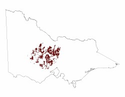 |
The Mount Dryden Hills are a sequence of isolated low hills to the east of the Grampians Ranges. Trending north-westerly, these hills are 60–100 metres higher the surrounding alluvial plains. Slopes are steep with topography of these hill more subdued in the south where slopes tend to be moderately to gently inclined. Mount Dryden is the highest (382 m) and largest outcrop and due to the isolated nature of outcrops, has radial drainage patterns that feed into Mount William Creek. In the upper reaches of Mount Cole Creek and the Wimmera River, low hills occur as isolated outcrops adjacent to neighbouring granite plutons. Slopes here are moderate to gentle with little significant relief.
The Concongella Hills are surrounded by a suite of landforms that underlie these topographically prominent features. Low hills, rises, plains and drainage depressions are common within this landscape complex that is bound to the east by the Wimmera River/Mount Cole Creek and by Mount William Creek in the west. Hillslopes are steep to moderately inclined with remaining slopes of the landscape gently inclined. Drainage is dendritic away from the hills where radial drainage is dominant.
Extensions of the Pyrenees Ranges in the east of the upper Wimmera River catchment include hills east of Joel South. Here upper slopes are steep with long gently inclined lower slopes that converge into footslopes and rises that line Wattle Creek and Howard Creek.
The Mount Dryden hills are a fault-controlled belt of volcanic rocks (calc-alkaline andesitic and dacitic lava, intrusives and fine grained volcaniclastics) striking north-north-westerly (Cayley & Taylor 2001). Cainozoic sediments with ferruginised ironstone flank many slopes of these hills.
Further in the east, the landscapes are composed of sedimentary rocks that have been folded and faulted in post-Ordovician times. Metasediments that have experienced low grade regional metamorphism can be observed in subdued strike ridges to undulating hills of the Concongella Hills and surrounding landforms. Weathering is variable with pallid kaolinitic profiles tending to be deeper on areas of lower relative relief than topographically pronounced landforms are (e.g. mountains, escarpments). Palaeogene remnants (ferruginous duricrusts) are common on hillslopes and crests of low hills/rises.
Red texture contrast soils (Chromosols) that tend to be sodic (Sodosols) in lower topographic positions have developed on hills, valley slopes and plains. Surfaces are lightly textured well structured soil that has a sharp contrast with medium to heavy subsoils that have vastly slower infiltration rates. While slightly acidic at the surface, they become alkaline at depth with profiles on lower slopes having deeper profiles than steeper upper slopes. Variable amounts of coarse weathered bedrock fragments and quartz occur throughout the profile.
Vegetation communities reflect variation in climate, aspect, geology and morphology. The Mount Dryden Hills has Heathy Woodland, Plains Grassy Woodland and Shrubby Woodland found on well drained soils. Vegetation communities such as Creekline Grassy Woodland and Seasonally Inundated Shrubby Woodland are found on lower slopes and drainage depressions.
The Concongella Hills and Rhymney low hills area has remnant vegetation dominated by forest and woodland areas. The main vegetation communities include Heathy Dry Forest, Grassy Dry Forest, Grassy Woodland, Plains Grassy Woodland, Alluvial Terraces Herb-rich Woodland and Heathy Woodland. Creekline Grassy Woodland occurs in lowest positions of these landscapes. Granitic Hills Woodland can also be located on these non-granitic landforms.
Adjoining the Pyrenees Ranges, remnant forest and woodland areas dominate vegetation. Heathy Dry Forest, Grassy Forest, Box Ironbark Forest and Grassy Dry Forest are found in exposed areas, Hillcrest Herb-rich Woodland, Grassy Woodland, Creekline Grassy Woodland and Plains Woodland found in more sheltered areas, or in areas at higher altitudes.
The Concongella Hills are an extremely vulnerable landscape to erosion and dryland salinity. Gully and tunnel erosion, sheet and rill erosion, are common on moderate to steep slopes especially where remnant vegetation has been removed for grazing purposes. Landslides and mud flows are likely where steep to very steep slopes occur, especially on lower peripheral landscapes within the Pyrenees Ranges.
Salinity processes within the metasediments of the upper catchment are driven by local to intermediate groundwater flow systems within fractured bedrock. Groundwater processes operate within the top 50–100 metre of the landscape where groundwater discharge often occurs at break of slope. Bedrock of lower relief partially discharge within the upper catchment with salinity levels derived from vast salt stores varied between 3 000 mg/l to 12,000 mg/l (Wimmera Regional Salinity Action Plan 2005 (external link) To view the information PDF requires the use of a PDF reader. This can be installed for free from the Adobe website (external link)).
© State of Victoria (Agriculture Victoria) 1996 - .

This work, Victorian Resources Online, is licensed under a Creative Commons Attribution 4.0 licence. You are free to re-use the work under that licence, on the condition that you credit the State of Victoria (Agriculture Victoria) as author, indicate if changes were made and comply with the other licence terms.
The licence does not apply to ‘branding’ or some ‘images or photographs’ that may be owned by third parties. We ask you to seek prior approval to use images using the VRO feedback form. Access to higher quality images can also be provided on request.
This page was last updated on .