
1.3.3 Terraces, fans and floodplains (Kiewa Valley, Wonnangatta Valley)
1. Eastern Uplands (EU)
1.3.1 Low relief landscapes at low elevation (Cann River south, Silvan, Templestowe)
1.3.2 Enclosed landscapes of low relief (Murmungee, Omeo, Dargo, Buldah)
1.3.3 Terraces, fans and floodplains (Kiewa Valley, Wonnangatta Valley)
1.3.4 Karst with depressions (Buchan)
| This Tier consists of alluvial terraces and floodplains, and the alluvial/colluvial fans that occur within the main valleys where the streams have reached a stable gradient, and are depositing the sediments that have been derived from the slow, natural (“geological”) erosion. This includes slope processes on the steeper valley sides, and the deepening and widening of the stream channels. However, in some stream systems, post-settlement erosion has added significant amounts of sediment to the floodplains. For example, extensive alluvial mining in the catchment of Yackandandah Creek in the 19th century resulted in deposition of about half a metre of orange sediment where it emerges onto the Kiewa River floodplain. The major stream systems draining the northern slopes of the Eastern Uplands, the Goulburn, Broken, Ovens, Kiewa, Mitta Mitta and Upper Murray Rivers, emerge onto the Northern Riverine plain (Tier 4). The southern draining streams, the La Trobe, Thomson, Macalister, Avon, Mitchell, Tambo and Snowy Rivers, emerge onto the Eastern Riverine Plain (Tier 7). Some highland streams have long, narrow, alluvial sectors where relatively softer sediments have been excavated or where streams have been temporarily dammed by alluvial fans from tributary valleys. The broad alluviated valley of the upper Wonnangatta River is of this type and may have originated by this mechanism or through damming by a hard rock barrier since breached. Because the levels of alluviation and dissection in such stream systems on a regional scale are controlled by regional base levels, the most important being sea level, differences may be expected between the southern members of this Tier where the coast is only some 20-50 km away, and the northern members where the coast is over 2000km away at the mouth of the Murray River. The flood-plain of the Murray River at Wodonga at the northern edge of Tier 1.3.3 is about 150 m above sea level making the average gradient between Wodonga and the sea about 1m in 15 km, i.e. 1 in 15000. | 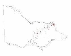 |
The effect of sea level changes on the extent and vertical separation of the terraces of the northern steam systems differs from the southern streams. In cross-section the lower parts of the valleys of the southern streams are mostly V-shaped and lack significant sediment fill. In some streams three narrow river terraces may be present, the highest up to 30m above the present stream level.
By contrast, the lower parts of the valleys of the northern streams are partially infilled with alluvium and have open U-shaped or sometimes angled cross-sections, with the flat alluvial surface meeting the sloping sides at an angle. At least three broad terraces separated by only a few metres occur in the lower reaches of many of the northern streams.
Many of the southern members of this Tier emerge from the confining hilly landscapes onto the Eastern Plain (Tier 7) where the higher parts of the landscape are ancient marine terraces that, in a less distinctive way, are also confining the largely younger riverine landforms.
Over much of these landscapes the vegetation is the open forest of peppermints and gums listed under Tier 1.2. However, the vegetation varies widely in structure and species composition as a result of the range of climate over the unit, and in some situations differences in soil parent material. The floodplain and lower terraces typically have open woodlands of river red gum.
In the upper valleys, the soils on the older fans and upper terraces are mainly red and brown gradational soils (Dermosols) on well-weathered sediments. Red and brown acid texture contrast soils (Kurosols) are dominant in the drier parts of the lower valleys. The soils on the intermediate members of the terrace and fan sequence are typically gradational soils with weak B-horizon structure (Kandosols). The flood plains have recently deposited sediments that may show clear stratification (Stratic Rudosols).
© State of Victoria (Agriculture Victoria) 1996 - .

This work, Victorian Resources Online, is licensed under a Creative Commons Attribution 4.0 licence. You are free to re-use the work under that licence, on the condition that you credit the State of Victoria (Agriculture Victoria) as author, indicate if changes were made and comply with the other licence terms.
The licence does not apply to ‘branding’ or some ‘images or photographs’ that may be owned by third parties. We ask you to seek prior approval to use images using the VRO feedback form. Access to higher quality images can also be provided on request.
This page was last updated on .