
1.3.1 Low relief landscapes at low elevation (Cann River south, Silvan, Templestowe)
1. Eastern Uplands (EU)
1.3.1 Low relief landscapes at low elevation (Cann River south, Silvan, Templestowe)
1.3.2 Enclosed landscapes of low relief (Murmungee, Omeo, Dargo, Buldah)
1.3.3 Terraces, fans and floodplains (Kiewa Valley, Wonnangatta Valley)
1.3.4 Karst with depressions (Buchan)
| To the north of the Divide, areas of undulating plains and low hills cut in Lower Palaeozoic sedimentary rocks and granites, characterise the Wedderburn, Bendigo and Rushworth districts, as the landscape gently descends to the Northern Riverine Plains (Tier 4). The low hills south of Wodonga, and at Chiltern and Springhurst are also included. On the southern side of the Eastern Uplands, a dissected plateau-like surface of hills known as the Nillumbik Terrain extends from the eastern suburbs of Melbourne (e.g., Camberwell and Templestowe) around Mt Dandenong and further eastwards to the NSW border. The hilly landscape to the east from Cann River to the border has the appearance of a dissected plateau. The vegetation of the northern areas consists mainly of the typical box – ironbark open forest of grey box, yellow box, red box, yellow gum and red ironbark with sparse understory of sclerophyllous shrubs and perennial grasses. Forest red gum forms grassy open forest or woodland along drainage lines. The soils in the northern areas are predominantly red to yellow acid texture soils (Kurosols). | 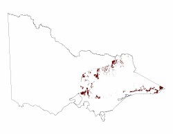 |
© State of Victoria (Agriculture Victoria) 1996 - .

This work, Victorian Resources Online, is licensed under a Creative Commons Attribution 4.0 licence. You are free to re-use the work under that licence, on the condition that you credit the State of Victoria (Agriculture Victoria) as author, indicate if changes were made and comply with the other licence terms.
The licence does not apply to ‘branding’ or some ‘images or photographs’ that may be owned by third parties. We ask you to seek prior approval to use images using the VRO feedback form. Access to higher quality images can also be provided on request.
This page was last updated on .