
Wimmera Irrigation Soil/Landform Mapping
Back to: Wimmera - Landscape Units
This is a clickable map. Click on Landform description in Legend for detailed information
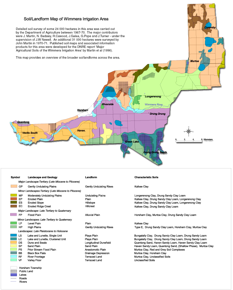
| Wimmera Irrigation Area Soil Mapping - Soil/Landform Mapping | |
| Major Landscape: Tertiary (Late Miocene to Pliocene) | Landscapes: Late Pleistocene to Holocene |
| GP - Gently undualting plains | LS - Lake and lunette - single unit |
| LC - Lake and lunette - clustered unit | |
| Minor Landscapes: Tertiary (Late Miocene to Pliocene) | DS - Dune and swale |
| MP - Moderately undulating plains | SP - Sand plain |
| EP - Eroded plain | PS - Prior stream flood plain |
| ES - Eroded slope | BB - Black box flats |
| EC - Eroded ridge crest | RF - River frontage |
| VF - Valley floor | |
| Major Landscape: Late Tertiary to Quaternary | |
| FP - Flood plain | |
| Minor Landscapes: Late Tertiary to Quaternary | |
| LP - Level plain | |
| HP - High plains | |
© State of Victoria (Agriculture Victoria) 1996 - .

This work, Victorian Resources Online, is licensed under a Creative Commons Attribution 4.0 licence. You are free to re-use the work under that licence, on the condition that you credit the State of Victoria (Agriculture Victoria) as author, indicate if changes were made and comply with the other licence terms.
The licence does not apply to ‘branding’ or some ‘images or photographs’ that may be owned by third parties. We ask you to seek prior approval to use images using the VRO feedback form. Access to higher quality images can also be provided on request.
This page was last updated on .