
Gently Undulating Plains
Map symbol: GP
The gently undulating plains landscape unit occupies more than half of the survey area north and east of Murtoa. Other areas occur near Longerenong Agricultural College, Riverside and east of Quantong. The landform is that of gently undulating plains with long gentle slopes. Buloke is the characteristic tree species and occurs singly and occasionally in fairly dense stands. The grassland formation also occurs on this landscape. The characteristic soil type is Kalkee clay.
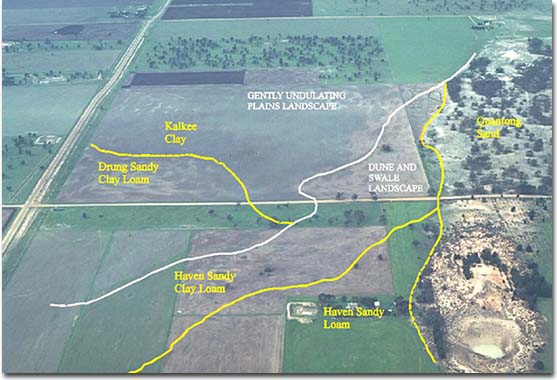
Gently undulating plain landscape in the Quantong area. Areas of Kalkee clay are shown together with Drung Sandy Clay Loam in the higher parts of the landscape.
© State of Victoria (Agriculture Victoria) 1996 - .

This work, Victorian Resources Online, is licensed under a Creative Commons Attribution 4.0 licence. You are free to re-use the work under that licence, on the condition that you credit the State of Victoria (Agriculture Victoria) as author, indicate if changes were made and comply with the other licence terms.
The licence does not apply to ‘branding’ or some ‘images or photographs’ that may be owned by third parties. We ask you to seek prior approval to use images using the VRO feedback form. Access to higher quality images can also be provided on request.
This page was last updated on .