
Eroded Slope
Map symbol: ES
The two representative map units of this landscape occur south of the Wimmera highway near the Yarriambiack Creek. Landforms are gently to moderately sloping plains. Characteristic soil types include Drung sandy clay loam, Longeranong clay and Kalkee clay. Vegetation was probably Buloke.
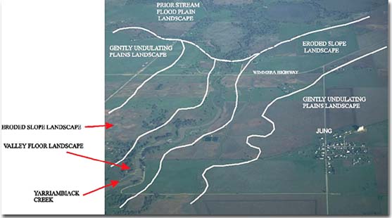
Eroded Slope landscape unit adjoining the Valley Floor landscape unit (Yarriambiack Creek) near Jung.
© State of Victoria (Agriculture Victoria) 1996 - .

This work, Victorian Resources Online, is licensed under a Creative Commons Attribution 4.0 licence. You are free to re-use the work under that licence, on the condition that you credit the State of Victoria (Agriculture Victoria) as author, indicate if changes were made and comply with the other licence terms.
The licence does not apply to ‘branding’ or some ‘images or photographs’ that may be owned by third parties. We ask you to seek prior approval to use images using the VRO feedback form. Access to higher quality images can also be provided on request.
This page was last updated on .