
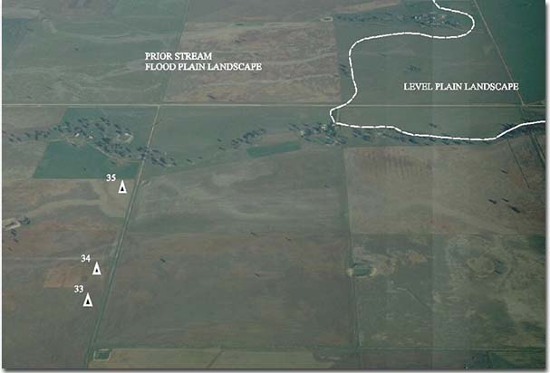
Prior Stream Flood Plain
Map symbol: PS
The prior stream flood plain landscape unit is situated north of the Wimmera River between Two Mile Creek and Murtoa. The Yarriambiack and Corkers Creeks flow north from the Wimmera River across the landscape to the Darlot Swamp area.
Near creeks, the sequence of stream courses and levee banks result in a regular gently undulating topography. Elsewhere in the landscape the ground surface is typically flat with occasional slight rises. Grey Box, Buloke, Yellow Gum and Black Box all occur singly and occasionally in small stands. Original vegetation may have included areas of Spear grass and Wallaby grass.
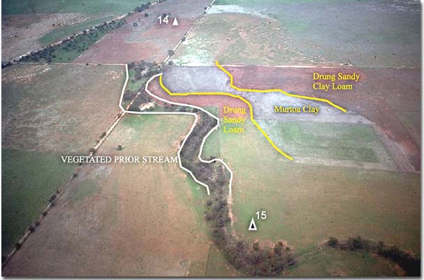
The Prior Stream flood plain landscape unit has the greatest number and the most complex distribution of soil types in the area. Horsham clay and Murtoa clay are the typical soil types of the relatively level areas between prior streams whereas Drung sandy loam and Drung sandy clay loam are the main soil types of the levees and of the occasional slight rises.
© State of Victoria (Agriculture Victoria) 1996 - .

This work, Victorian Resources Online, is licensed under a Creative Commons Attribution 4.0 licence. You are free to re-use the work under that licence, on the condition that you credit the State of Victoria (Agriculture Victoria) as author, indicate if changes were made and comply with the other licence terms.
The licence does not apply to ‘branding’ or some ‘images or photographs’ that may be owned by third parties. We ask you to seek prior approval to use images using the VRO feedback form. Access to higher quality images can also be provided on request.
This page was last updated on .