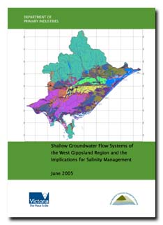
Groundwater Flow Systems Report (2005)
Back to Salinity Management
This study presents the distribution and characteristics of Groundwater Flow Systems (GFS) causing salinity in the West Gippsland region. As part of developing this document, a workshop involving key technical, agency and community representatives was held on 24-25 February 2005. A total of 12 Groundwater Flow Systems were defined for the West Gippsland region using a combination of information on geology, hydrogeology, soils, slope and local knowledge.
To view the information PDF requires the use of a PDF reader. This can be installed for free from the Adobe website (external link).
 | Front page and Table of Contents (PDF 453KB) | |
| Acknowledgements (PDF 21KB) | ||
| Executive Summary (PDF 33KB) | ||
1 | Introduction (PDF 1.0MB) | |
2 | Method 2.1 Key data sets to compile GFS maps (PDF 36KB) Figure 5 - Surface geology (PDF 992KB) Figure 6 - Elevation (PDF 863KB) Figure 7 - Ground slope (PDF 1.0MB) Figure 8 - Soils permeability (PDF 245KB) 2.2 Key additional data sets used to determine GFS characteristics (PDF 27KB) | |
3 | Management options (PDF 81KB) | |
4 | Groundwater Flow Systems (PDF 236KB) | |
5 | Summary of salinity management options in the context of groundwater flow systems (PDF 255KB) | |
6 | The next step (PDF 27KB) | |
7 | References (PDF 25KB) | |
| Appendix A - Maps used to characterise the GFS (PDF 650KB) Figure 29 - Watertable Depth (m) (PDF 248KB) Figure 30 - Annual Rainfall (mm) (PDF 246KB) Figure 31 - Potential Annual Evaporation (mm) (PDF 691KB) Figure 32 - Landsat (2000) (PDF 731KB) Figure 33 - Land Use (PDF 1.3MB) |
West Gippsland Groundwater Flow System | |||
Number | Dominant Flow System | Sub-dominant Flow System | Description |
| GFS1 (PDF 127KB) | Local | Intermediate | Palaeozoic bedrock |
| GFS2 (PDF 225KB | Local | Intermediate | Mesozoic bedrock |
| GFS3 (PDF 151KB) | Local | Intermediate | Tertiary basalts |
| GFS4 (PDF 210KB) | Intermediate | Tertiary sediments Rosedale area including Sale and Moe | |
| GFS5 (PDF 250KB) | Local | Tertiary sediments general | |
| GFS6 (PDF 114KB) | Local | Recharge area for deep Latrobe GP aquifer | Tertiary sediments - high slope (Latrobe GP recharge area) |
| GFS7 (PDF 274KB) | Local | Quaternary sediments - Upper Bengworden region | |
| GFS8 (PDF 218KB) | Local | Intermediate | Quaternary sediments - Lower Bengworden region |
| GFS9 (PDF 349KB) | Intermediate | Quaternary sediments - MID | |
| GFS10 (PDF 305KB) | Intermediate | Quaternary sediments general (lower permeability soils) | |
| GFS11 (PDF 199KB) | Intermediate | Quaternary sediments general (higher permeability soils) | |
| GFS12 (PDF 152KB) | Local | Intermediate | Recent alluvials |
| GFS13 (PDF 135KB) | Local | Quaternary sediments coastal dunes | |


