
5.1.5 Hummocky dunes sub-dominant (Hopetoun, Peppers Plains)
|
Across the north-west corner of the WCMA region (running from Yellangip to Wilkur South) are plains on which there are scattered low hummocks. Known from previous reports as the Culgoa landsystem (Rowan & Downes 1963), the scattered low hummocky dunes tend to occur in cluster ranging up to some 3 km across. Unlike unit 5.1.3, subdued ridges with superimposed recent dunes are absent from surface expression within this landscape. As a result, relative relief across these landforms is much lower than neighbouring landforms of landscapes to the north. | 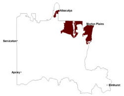 |
Gilgaied clays are by far the most widespread soils, occupying the plains and the gentler dune slopes. These cracking clays are often dark and self-mulching with vertic medium clay subsoils that may have calcareous segregations present. Sodic, red, grey and yellow texture contrast soils (Sodosols) are more prominent on dune slopes and hummocks. Surfaces of these soils are sandy loams with strong change to medium clay subsoils that are extremely sodic in nature. Colour for these subsoils is often a good hydromorphic indicator with red variants usually found higher in the landscape.
Remnant vegetation consists of a variety of mallee, woodland and shrubland vegetation. Vegetation communities recorded include Parilla Mallee, Plains Savannah, Ridged Plains Mallee, Red Swale Mallee, Sandstone Ridge Shrubland, Riverine Chenopod Woodland, Plains Woodland, Low Rises Woodland, and Lignum Swampy Woodland that is associated with creeklines and swampy areas. Plains Grassland, Plains Woodland and Plains Savannah are more common in the north-east. Mallee species are scattered and widespread with remnant vegetation open stands of big mallee found on plains with heavy soils, and medium mallee on the dunes. Scattered remnants of pine and buloke woodland are also prevalent in this area of the WCMA region.
Agricultural production is limited on the clay soils because of low storage of available water under the semi-arid climate, and this effect increases with increasing aridity towards the north. The wind erosion hazard is high only on upper western dune slopes. Seepage salinity has not been noted.
Soil-landform unit | Unit description | Area (km2) |
| Beulah plains | Gently undulating plains | 54 |
| Brim undulating rises | Gently undulating rise | 123 |
| Charlton gentle rises | Moderating undulating plains | 218 |
| Donald lake-lunettes | Lake-lunette system cluster | 28 |
| Hopetoun rises and swales | Undulating rises | 660 |
| Jerro eroded ridges and slopes | Eroded ridge and slopes | 56 |
| Kalkee plains | Gently undulating plains | 86 |
| Kalkee plains2 | Gently undulating plains | 94 |
| Morton drainage plains | Drainage lines | 18 |
| Murra Warra East gentle rises | Moderately undulating plains | 83 |
| Rainbow hummocky dunes and plains | Hummocky dunes | 86 |
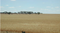
Figure 13 Long gentle slopes with subdued rises near Warracknabeal
© State of Victoria (Agriculture Victoria) 1996 - .

This work, Victorian Resources Online, is licensed under a Creative Commons Attribution 4.0 licence. You are free to re-use the work under that licence, on the condition that you credit the State of Victoria (Agriculture Victoria) as author, indicate if changes were made and comply with the other licence terms.
The licence does not apply to ‘branding’ or some ‘images or photographs’ that may be owned by third parties. We ask you to seek prior approval to use images using the VRO feedback form. Access to higher quality images can also be provided on request.
This page was last updated on .