
Soil/Landform Unit - Hopetoun rises and swales
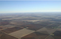 View west from Warrachnabeal towards Lake Hindmarsh across a sequence of ridges and swales |
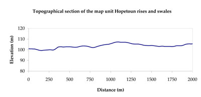
4.24% of CMA region The landscape is composed of a series of NNW-SSE trending ridges (gentle rises) upon which aeolian dunes are superimposed. The average distance between ridge crests is about 3 to 3.5 kilometres, relative relief of the ridges is generally less than 10 metres and dunes are weakly developed and few. As part of the North West Dunefields and Plains, this landscape provides the southern extent of a landscape that continues far into the Mallee CMA region. Representing an area of transition from ‘Mallee soils’ to ‘Wimmera soils’, the sodic red texture contrast soils (Sodosols) and calcareous gradational soils (Calcarosols) are found on the middle to upper rise slopes and crests. Cracking clay soils (Vertosols) predominate on lower slopes and inter-ridge plains. Dunes tend to be Sodosols with deep and sandy surfaces. Soil surfaces are variable from hardsetting surfaces that are susceptible to sheet and rill erosion along with wind erosion to well-drained surfaces that can be imperfectly drained at depth. Remnant vegetation consists of a variety of mallee, woodland, and shrubland vegetation including Parilla Mallee, Plains Savannah, Plains Woodland, Ridged Plains Mallee, Red Swale Mallee and Sandstone Ridge Shrubland. | 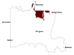 |
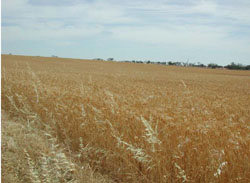 Cereal cropping is a major land use of these rises and swales | 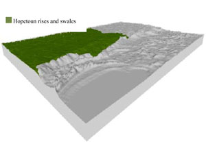 |
 | 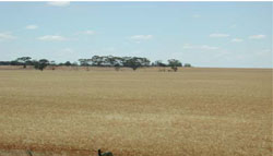 Remnant vegetation on a gentle rise slope |
Component | 1 | 2 | 3 | 4 |
Proportion of soil-landform unit | 10% | 60% | 20% | 10% |
| CLIMATE Rainfall (mm) | Annual: 370 | |||
| Temperature (oC) | Minimum 9, Maximum 22 | |||
| Precipitation less than potential evapotranspiration | September–April | |||
| GEOLOGY Age and lithology | Quaternary paludal silt and clay; Neogene marine sand and silt (Parilla Sand) | |||
| Geomorphology | ||||
| LANDUSE | Uncleared areas: Nature conservation Cleared areas: Dryland cropping; sheep grazing | |||
| TOPOGRAPHY Landscape | Rises and swales | |||
| Elevation range (m) | 68–133 | |||
| Local relief (m) | 5–6 | |||
| Drainage pattern | Parallel–dendritic | |||
| Drainage density (km/km2) | 0.5 | |||
| Landform | Low rises | Plains | ||
| Landform element | Ridge crest | Ridge (rise) slope | Plain and swale | Dune |
| Slope and range (%) | 3 (2-6) | 2 (1-5) | 1 (0-3) | 3 (0-5) |
| Slope shape | Convex | Linear | Straight | Concave |
| NATIVE VEGETATION Ecological Vegetation Class | Ridged Plains Mallee (39.9%), Plains Savannah (17.8%), Low Rises Woodland (17.3%), Plains Woodland (6.4%), Other (10.6%) | |||
| SOIL Parent material | Marine sand and silt | Marine sand and silt | Paludal silt and clay | Aeolian dune sand |
| Description (Corangamite Soil Group) | Sodic red texture contrast soils (27) | Cracking clay soils (29) | Sodic red texture contrast soils (27) | |
| Soil type sites | ||||
| Surface texture | Sandy loam | Sandy clay loam | Fine sandy clay loam | Sandy loam |
| Permeability | Moderate | Moderate | Slow | Moderate |
| Depth (m) | > 1.5 | > 2 | > 2 | > 1.5 |
| LAND CHARACTERISTICS, POTENTIAL AND LIMITATIONS Critical land features, processes, forms | Hardsetting surface susceptible to sheet and rill erosion along with wind erosion. Dispersive and deep subsoils susceptible to gully erosion on steeper slopes. Soils are prone to compaction at critical moisture contents. | Surfaces are variable from hardsetting surfaces that are susceptible to sheet and rill erosion along with wind erosion to well drained surfaces that can be imperfectly drained at depth. Subsoil may be dispersive and subject to erosion. | Surfaces are slightly vulnerable to sheet erosion and wind erosion. Soils may be susceptible to compaction. | Weakly structured soil surface susceptible to sheet and rill erosion along with wind erosion. Dispersive and deep subsoils susceptible to gully erosion on steeper slopes. Soils are prone to compaction. |
© State of Victoria (Agriculture Victoria) 1996 - .

This work, Victorian Resources Online, is licensed under a Creative Commons Attribution 4.0 licence. You are free to re-use the work under that licence, on the condition that you credit the State of Victoria (Agriculture Victoria) as author, indicate if changes were made and comply with the other licence terms.
The licence does not apply to ‘branding’ or some ‘images or photographs’ that may be owned by third parties. We ask you to seek prior approval to use images using the VRO feedback form. Access to higher quality images can also be provided on request.
This page was last updated on .