
Soil/Landform Unit - Kalkee plains2
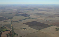 Cultivated Kalkee plains near Carron with minor drainage system defined by lines fo remnant vegetation |
1.54% of CMA region North of the Wimmera River as it emerges from the Dissected Western Uplands are the clay plains for which the Wimmera is renowned. The Kalkee plains are synonymous with the self-mulching grey clays that have supported cereal cropping for much of the last century. These clay plains (Kalkee plains) have been divided into two units with this unit comprising a significant proportion of coloured variants to the traditional Kalkee clay. These clay soils are only found west of the Yarriambiack River. Comprising very gentle rises and plains, drainage across these plains is very subtle and often poorly defined. The self-mulching Vertosols have high clay contents that can be variable due to micro relief and presence of gilgai. Soils may also be susceptible to inundation and periodic waterlogging during significant rainfall events. The dominant remnant vegetation community is Plains Savannah. Other remnant vegetation includes Low Rises Woodland, Plains Woodland, Riverine Chenopod Woodland and Plains Grassland. | 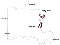 |
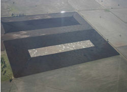 Cultivated land with gilgai | 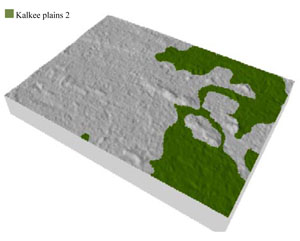 |
 |
Component | 1 | 2 | 3 | 4 |
Proportion of soil-landform unit | 5% | 10% | 78% | 7% |
| CLIMATE Rainfall (mm) | Annual: 402 | |||
| Temperature (oC) | Minimum 9, Maximum 21 | |||
| Precipitation less than potential evapotranspiration | September–April | |||
| GEOLOGY Age and lithology | ||||
| Geomorphology | ||||
| LANDUSE | Uncleared areas: nature conservation Cleared areas: dryland cropping; sheep grazing | |||
| TOPOGRAPHY Landscape | Gently undulating plains (Kalkee plains) | |||
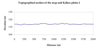
| Elevation range (m) | 104–155 | |||
| Local relief (m) | 2 | |||
| Drainage pattern | Dendritic | |||
| Drainage density (km/km2) | 0.4 | |||
| Landform | Very gentle rises | Plains | ||
| Landform element | Low rise crest | Low rise slope | Plain | Swamp/drainage depression |
| Slope and range (%) | 3 (1-7) | 5 (3-10) | 3 (1-8) | 0 (0-3) |
| Slope shape | Convex | Convex | Concave | Concave |
| NATIVE VEGETATION Ecological Vegetation Class | Plains Savannah (36.9%), Plains Woodland (20.6%), Riverine Chenopod Woodland (15.3%), Plains Grassland (11.1%), Other (9.0%) | |||
| SOIL Parent material | Aeolian sand and silt | Aeolian sand and silt | Marine sand and silt, and paludal silt and clay | Paludal silt and clay |
| Description (Corangamite Soil Group) | Cracking clay soils (34) | Cracking clay soils (34) | ||
| Soil type sites | ||||
| Surface texture | Sandy loam to medium clay | Medium clay | Medium clay | Light clay |
| Permeability | Moderate | Moderate | Moderate | Slow |
| Depth (m) | 1.5 | > 3 | > 3 | > 3 |
| LAND CHARACTERISTICS, POTENTIAL AND LIMITATIONS Critical land features, processes, forms | Hardsetting upper soil susceptible to sheet and rill erosion along with wind erosion when exposed. High clay surfaces result in restricted soil drainage, but can be variable due to micro relief (gilgai).Dispersive and deep subsoils susceptible to gully erosion on steeper slopes. Compaction of upper soil variable depending on soil depth and moisture content. Upper soil is susceptible to acidification. | High clay content results in restricted soil drainage, but can be variable due to micro relief (gilgai). Soils may be susceptible to inundation and waterlogging. Surface soils are friable and only slightly susceptible to wind erosion due to self-mulching and massive nature. Soils may be susceptible at critical moisture contents and have variable resilience to compaction. | High clay content results in restricted soil drainage, but can be variable due to micro relief (gilgai). Soils may be susceptible to inundation and waterlogging. Surface soils are friable and only slightly susceptible to wind erosion due to self-mulching and massive nature. Soils may be susceptible at critical moisture contents and have variable resilience to compaction. | Susceptible to seasonal inundation, waterlogging and ultimately soil salinity. Upper soils susceptible to sheet erosion and wind erosion when exposed. |
© State of Victoria (Agriculture Victoria) 1996 - .

This work, Victorian Resources Online, is licensed under a Creative Commons Attribution 4.0 licence. You are free to re-use the work under that licence, on the condition that you credit the State of Victoria (Agriculture Victoria) as author, indicate if changes were made and comply with the other licence terms.
The licence does not apply to ‘branding’ or some ‘images or photographs’ that may be owned by third parties. We ask you to seek prior approval to use images using the VRO feedback form. Access to higher quality images can also be provided on request.
This page was last updated on .