
Soil/Landform Unit - Charlton gentle rises
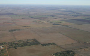 Gentle rises east of Homecroft |
0.93% of CMA region The Charlton gentle rises soil-landform unit is located in the north-east of the catchment and continues to the east. The gentle rises occur within the Hummock dunes sub-dominant of the Calcareous North Western Dunefields and Plains (5.1.5) geomorphology unit of the region where rises and plains are dominant landform elements. While the rises are known for their sodic red texture contrast soils (Sodosols), the plains are mainly cracking clays (Vertosols) with sodic red texture contrast soils intermixed. Land use is mainly dryland cereal cropping with soil compaction a major land degradation theme. Native vegetation of these gentle rises and plains include Low Rises Woodland, Ridged Plains Mallee, Riverine Chenopod Woodland, Plains Grassland, Plains Woodland and Plains | 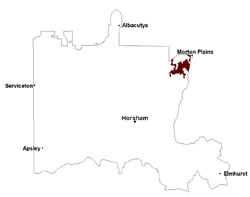 |
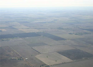 Gilgai plains with gentle rises | 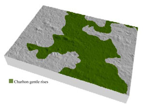 |
| 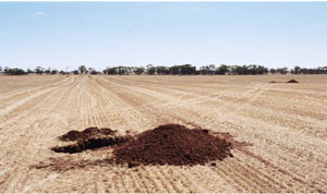 Looking north towards down slope of a gentle rise |
Component | 1 | 2 | 3 |
Proportion of soil-landform unit | 5% | 25% | 70% |
| CLIMATE Rainfall (mm) | Annual: 370 | ||
| Temperature (oC) | Minimum 9, Maximum 22 | ||
| Precipitation less than potential evapotranspiration | September–April | ||
| GEOLOGY Age and lithology | Neogene marine sand and silt (Parilla Sand); Quaternary alluvium, gravel, sand and silt | ||
| Geomorphology | |||
| LANDUSE | Uncleared areas: nature conservation Cleared areas: dryland cropping; sheep grazing | ||
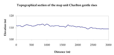
| TOPOGRAPHY Landscape | Moderately undulating plains | ||
| Elevation range (m) | 102–123 | ||
| Local relief (m) | 3–5 | ||
| Drainage pattern | Dendritic | ||
| Drainage density (km/km2) | 0.4 | ||
| Landform | Gentle rises | ||
| Landform element | Rise crest (moderate) | Rise slope (moderate) | Plain |
| Slope and range (%) | 3 (1-7) | 5 (3-10) | 3 (1-8) |
| Slope shape | Convex | Linear | Concave |
| NATIVE VEGETATION Ecological Vegetation Class | Plains Savannah (37.6%), Plains Woodland (35.6%), Other (21.5%) | ||
| SOIL Parent material | Marine sand and silt | Marine sand and silt | Marine and alluvial gravel, sand and silt |
| Description (Corangamite Soil Group) | Sodic red texture contrast soils (27) | Sodic red texture contrast soils (27) | Cracking clay soils (29) |
| Soil type sites | |||
| Surface texture | Sandy loam | Sandy loam | Fine sandy clay loam |
| Permeability | Moderate | Moderate | Slow |
| Depth (m) | > 1.5 | > 1.5 | > 2 |
| LAND CHARACTERISTICS, POTENTIAL AND LIMITATIONS Critical land features, processes, forms | Hardsetting weakly structured soil surface susceptible to sheet and rill erosion along with wind erosion. Dispersive and deep subsoils susceptible to gully erosion where exposed. Soils are prone to compaction at critical moisture contents. | Hardsetting weakly structured soil surface susceptible to sheet and rill erosion along with wind erosion. Dispersive and deep subsoils susceptible to gully erosion on steeper slopes. Soils are prone to compaction at critical moisture contents. | Soils can be subject to inundation and waterlogging especially in low-lying areas. Surfaces are slightly vulnerable to sheet erosion and wind erosion. Soils may be susceptible to compaction. |
© State of Victoria (Agriculture Victoria) 1996 - .

This work, Victorian Resources Online, is licensed under a Creative Commons Attribution 4.0 licence. You are free to re-use the work under that licence, on the condition that you credit the State of Victoria (Agriculture Victoria) as author, indicate if changes were made and comply with the other licence terms.
The licence does not apply to ‘branding’ or some ‘images or photographs’ that may be owned by third parties. We ask you to seek prior approval to use images using the VRO feedback form. Access to higher quality images can also be provided on request.
This page was last updated on .