
Soil/Landform Unit - Morton drainage plains
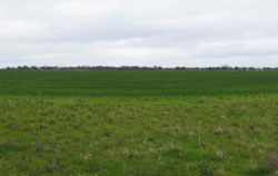 Morton plains, north-east of Watchem |
0.08% of CMA region The plains and depressions are part of the hummocky dunes subdominant landscape within the calcareous dunefield of the North West Dunefields and Plains. These plains are also associated with the older alluvial plains of the Northern Riverine Plains (4.2) to the east. These low-lying plains/depressions lie between other plains (Kalkee and Charlton) and low hummocky dunefields (Beulah), and are generally orientated NNW/SSE. The plains are dominant with a drainage depression as a minor component that receives drainage from the surrounding units, though the terrain is essentially flat. Soil types are predominantly red sodic texture contrast soils (Sodosols), with yellow, brown and grey sodictexture contrast soils (Sodosols) and occasional grey and brown cracking clay soils (Vertosols) in the depressions. There is little resistance to wind movement due to the cleared flat terrain. Compaction is also a potential land degradation susceptibility, as is waterlogging in the depression and to some extent the plain, where topsoil is shallow. Dryland cropping is the major enterprise with some grazing (sheep). The four main vegetation communities found are Low Rises Woodland, Ridged Plains Mallee, Plains Woodland and Plains Savannah. | 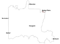 |
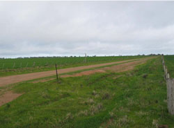 Plains with clayey roads | 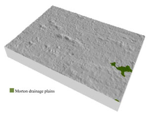 |
 | 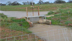 Channel weir |
Component | 1 | 2 |
Proportion of soil-landform unit | 70% | 30% |
| CLIMATE Rainfall (mm) | Annual: 370 | |
| Temperature (oC) | Minimum 9, Maximum 22 | |
| Precipitation less than potential evapotranspiration | September–April | |
| GEOLOGY Age and lithology | Neogene marine sand and silt (Parilla Sand); Quaternary silt, sand and minor gravel (Shepparton Formation); Quaternary fluvial gravel, sand and silt; Quaternary aeolian lunettes, sand, silt and clay | |
| Geomorphology | ||
| LANDUSE | Uncleared areas: water supply; nature conservation Cleared areas: sheep grazing; dryland grazing | |
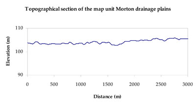
| TOPOGRAPHY Landscape | Gently undulating plains | |
| Elevation range (m) | 101–114 | |
| Local relief (m) | 1–2 | |
| Drainage pattern | Dendritic | |
| Drainage density (km/km2) | 0.1 | |
| Landform | Alluvial plains | |
| Landform element | Plain | Drainage depression/closed depression |
| Slope and range (%) | 1 (0-2) | 0 (0-2) |
| Slope shape | Straight | Straight |
| NATIVE VEGETATION Ecological Vegetation Class | Plains Savannah (45.0%), Plains Woodland (45.4%), Ridged Plains Mallee (5.4%), Low Rises Woodland (1.5%) | |
| SOIL Parent material | Fluvial gravel, sand and silt | Paludal silt and clay, fluvial sand and silt |
| Description (Corangamite Soil Group) | ||
| Soil type sites | ||
| Surface texture | Sandy loam | Loamy sand to clay loam |
| Permeability | Moderate | Slow |
| Depth (m) | > 2 | > 2 |
| LAND CHARACTERISTICS, POTENTIAL AND LIMITATIONS Critical land features, processes, forms | Hardsetting surface susceptible to sheet and rill erosion along with wind erosion. Dispersive and deep subsoils susceptible to gully erosion where exposed. Soils are prone to compaction at critical moisture contents. | Wind erosion along with sheet and rill erosion occur on hardsetting surfaces with little organic matter. Soils can be subject to inundation and waterlogging especially in low-lying areas. Subsoils are dispersive and susceptible to gully erosion on steeper slopes. Soils compact at critical moisture contents. |
© State of Victoria (Agriculture Victoria) 1996 - .

This work, Victorian Resources Online, is licensed under a Creative Commons Attribution 4.0 licence. You are free to re-use the work under that licence, on the condition that you credit the State of Victoria (Agriculture Victoria) as author, indicate if changes were made and comply with the other licence terms.
The licence does not apply to ‘branding’ or some ‘images or photographs’ that may be owned by third parties. We ask you to seek prior approval to use images using the VRO feedback form. Access to higher quality images can also be provided on request.
This page was last updated on .