
Salinity Provinces in the North Central Catchment Management Region
The North Central CMA Region covers about 13% of Victoria and extends from the steep rocky ridges of the Great Dividing Range in the south to wide alluvial plains in the north, terminating at the Murray River between the townships of Swan Hill and Echuca. The major river catchments are the Avoca, Avon-Richardson, Loddon and Campaspe Rivers. These rivers are typically deeply incised in the southern uplands and broad and spreading on the northern plains.
Elevation generally decreases northwards from 1000 m (AHD) at Mt Macedon (south) to 70 m (AHD) adjacent to the Murray River (north). Average annual rainfall also decreases to the north ranging from 720 mm at Woodend (south) to 320 mm at Swan Hill (north). Temperatures vary dramatically with topography, location and season. Summer maximums often exceed 38°C across much of the CMA, while in winter they range between 5°C and 15°C in the flatter country and often remain below zero in the uplands.
Natural vegetation makes up 19% of land cover with the remainder used for agriculture, which is generally irrigated in the north and dryland in the south. In the western region, dryland cereal cropping is common with some canola and legume crops.
Dryland salinity is an important land management issue in the region and entrenched within its Regional Catchment Strategy (RCS). Salt loads discharging to the Murray River have a negative impact on downstream water users including the environment. Major soil salinity problems associated with break-of-slope discharge occur in central and southern areas. Significant soil and water salinity is driven by the impact of flooding on shallow watertables particularly along the low-lying drainage lines of the Avon-Richardson Catchment and the Avoca Lakes area. Salinity associated with irrigation induced shallow watertables is a major management issue on the northern plains.
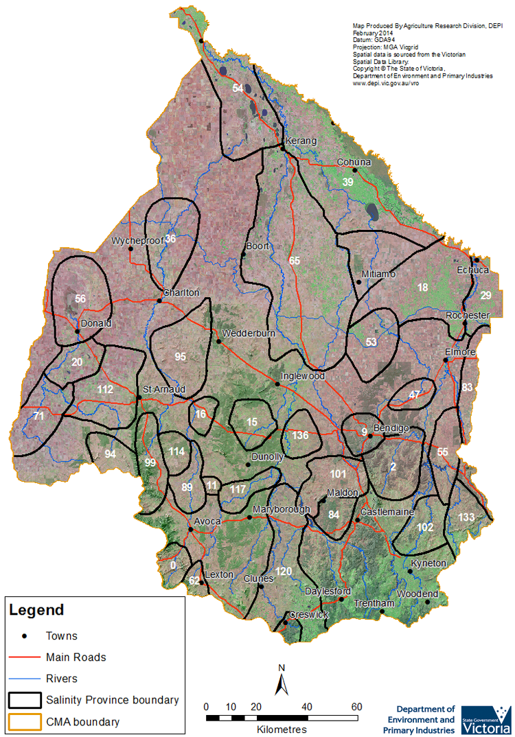
Groundwater Flow Systems within the region include local, intermediate and regional systems or a combination of these, typically increasing in scale northwards. To better understand and manage salinity, 33 Salinity Provinces, 22 of which are High priority, have been defined where similar geographic and biophysical conditions have been observed. Salinity has been recorded at over 1260 individually mapped units1 , which cover a total combined area of almost 26,000 hectares1 of the CMA.
The North Central CMA has an extensive range of online materials (maps and documents etc.) which outline the biophysical assets of the catchment, as well as their major risks (including soil and water salinity). This material also outlines the programs and projects currently being completed by the CMA to protect and enhance these assets. An example of this is the online data portal called the North Central CMA ‘iMap - Interactive Mapping System’, the link to which is provided at the base of this page.
Provinces displayed in this map are clickable or use the table of links provided
© State of Victoria (Agriculture Victoria) 1996 - .

This work, Victorian Resources Online, is licensed under a Creative Commons Attribution 4.0 licence. You are free to re-use the work under that licence, on the condition that you credit the State of Victoria (Agriculture Victoria) as author, indicate if changes were made and comply with the other licence terms.
The licence does not apply to ‘branding’ or some ‘images or photographs’ that may be owned by third parties. We ask you to seek prior approval to use images using the VRO feedback form. Access to higher quality images can also be provided on request.
This page was last updated on .