
Catchment Management
|
Sustainable use and protection of our catchments natural resources requires careful management to maintain the environmental integrity of the resource and to protect Victoria's reputation as a clean, green producer. |
The Victorian Catchment Management Council (VCMC) (external link) is the State Government’s key advisory body on catchment management.
Catchment Assessment Tool
The Catchment Assessment Tool (CAT) provides a modelling framework at a catchment scale to assess farming and forestry impacts on streams and groundwater. A series of fact sheets have been developed outlining CAT and its capabilities.
Catchment Management Authorities
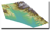
Connecting landscapes to water resource impacts
This project is a part of the eWater CRC 'Northern Vic Focus Catchments (Goulburn and Ovens)' project which is investigating how potential flow scenarios, based on land management and climate change, can affect the river and floodplain ecology of the Goulburn and Ovens Catchments.
Floodplain Management
Information on Floodplain Management on the DEPI website.
Groundwater and Surface Water Interaction
Groundwater connection to rivers plays a major role in the health and function of riverine environments in groundwater dependent wetland ecosystems. It also plays a primary role in stream water quality through the delivery of salt and other constituents (e.g., nitrate) to streams. There is not enough information available to develop appropriate groundwater and surface water management strategies to protect these ecosystems in many Australian catchments.
Local Government Authorities
Victoria's 78 Local Government Authorities have a range of responsibilities for land and water planning and management.
Root zone water fluxes for Victorian landscapes
Policy makers and natural resource managers are increasingly requiring spatially distributed information to support policy development, creation of policy instruments and management decisions on surface water and groundwater, wetlands and riparian zones, salinity, nutrients, and irrigation modernisation. Northern Victorian irrigated landscapes are undergoing significant, continuous and rapid changes in land use and water management practices in response to changing climatic conditions, markets and government policies. Hydrological processes at field to catchment scales are similarly undergoing major changes. Spatially distributed root zone water flux data, in particular reliable estimates of deep percolation under different land uses, soil types, watertable and climatic conditions are fundamental for modelling and managing these landscapes.
Water Supply Catchment Protection
These pages describe and map Victoria's 134 Declared Water Supply Catchments gazetted under the Catchment and Land Protection Act, 1994. Complementary responsibilities within other legislation or planning controls are also discussed.
Links to the 2002, 2007 and 2012 Victorian Catchment Condition reports (external-link) on the Victorian Catchment Management Council website.
© State of Victoria (Agriculture Victoria) 1996 - 2025.

This work, Victorian Resources Online, is licensed under a Creative Commons Attribution 4.0 licence. You are free to re-use the work under that licence, on the condition that you credit the State of Victoria (Agriculture Victoria) as author, indicate if changes were made and comply with the other licence terms.
The licence does not apply to ‘branding’ or some ‘images or photographs’ that may be owned by third parties. We ask you to seek prior approval to use images using the VRO feedback form. Access to higher quality images can also be provided on request.
This page was last updated on 22/02/2021.