
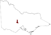
Salinity Province 120, Upper Loddon Volcanic Plains
|
|
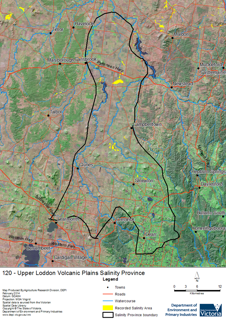
 The relatively large Upper Loddon Volcanic Plains Salinity Province extends from the volcanic plain adjacent to Cain Curren reservoir in the north to the meta-sedimentary ridges near Creswick in the south. Broadly, landuse varies with latitude and related rainfall distribution, the north being flatter and drier has significant cropping established whilst the south has significant horticulture farming. The local to intermediate scale Groundwater Flow Systems (GFSs) underlying the province consist of fractured volcanic aquifers with associated scoria cones overlying an extensive ‘deep lead’ (paleo-river channel) system. The deep lead was the target of extensive gold mining and now provides a source of irrigation water. Salinity occurs at three distinct areas; Long swamp (near Joyces Creek), Glengower and Smeaton. Each area is characterised by being a low-lying drainage basin with limited outflow, with likely groundwater discharge coming up from the intermediate scale GFSs.
 Province Attributes
| Catchment Management Region: | NORTH CENTRAL |
| Priority Status: | High |
| Province Area: | 97,610 ha |
| Recorded Soil Salinity Area 1: | 801 ha |
| Dominant Surface Geology Type: | Sedimentary |
| Influence of Geological Structure on Salinity Occurrence/s: | Probable |
| Relevant Geomorphological Mapping Units (GMUs): | 2.1.6 |
| Predominant Groundwater Flow Systems (GFSs): | Local/Intermediate |
| Relevant Irrigation Areas: | N/A |
Upper Loddon Volcanic Plains Salinity Province Map
Links to further reading and material related to the North Central Salinity Province
For further information relating to groundwater levels and salinities in this Province please see: Visualising Victoria's Groundwater (VVG)
1 Please Note: The ‘Recorded Soil Salinity Area’ indicated in the Salinity Province Attribute Table, comprises the total geographic area that has been mapped as having, or showing symptoms of, dryland soil salinity at some time (past or present). As dryland salinity occurrence in the Victorian landscape exhibits many different levels of severity and can change due to climate, landuse and vegetation, previously mapped areas may no longer be showing symptoms. In addition, as not all parts of the State have been mapped, or mapped in the same way, the mapping may not have captured some occurrences.
The soil salinity mapping used to calculate this ‘area’ does not cover irrigation regions. In irrigation regions, depth to watertable and watertable salinity mapping has been used to convey the threat of high watertables on soil waterlogging and/or soil salinisation and these areas are not included in this ‘area‘ calculation.
Please contact the Department, your Catchment Management Authority or your rural water provider for more information about salinity in your location.
© State of Victoria (Agriculture Victoria) 1996 - 2025.

This work, Victorian Resources Online, is licensed under a Creative Commons Attribution 4.0 licence. You are free to re-use the work under that licence, on the condition that you credit the State of Victoria (Agriculture Victoria) as author, indicate if changes were made and comply with the other licence terms.
The licence does not apply to ‘branding’ or some ‘images or photographs’ that may be owned by third parties. We ask you to seek prior approval to use images using the VRO feedback form. Access to higher quality images can also be provided on request.
This page was last updated on 23/03/2020.