Salinity Province 87, Murray Valley
|
|
Province Attributes
| Catchment Management Region: | GOULBURN BROKEN |
| Priority Status: | High |
| Province Area: | 171,860 ha |
| Recorded Soil Salinity Area 1: | 0 ha |
| Dominant Surface Geology Type: | Sedimentary |
| Influence of Geological Structure on Salinity Occurrence/s: | None |
| Relevant Geomorphological Mapping Units (GMUs): | 4.2.1 |
| Predominant Groundwater Flow Systems (GFSs): | Regional |
| Relevant Irrigation Areas: | Murray Valley, Shepparton |
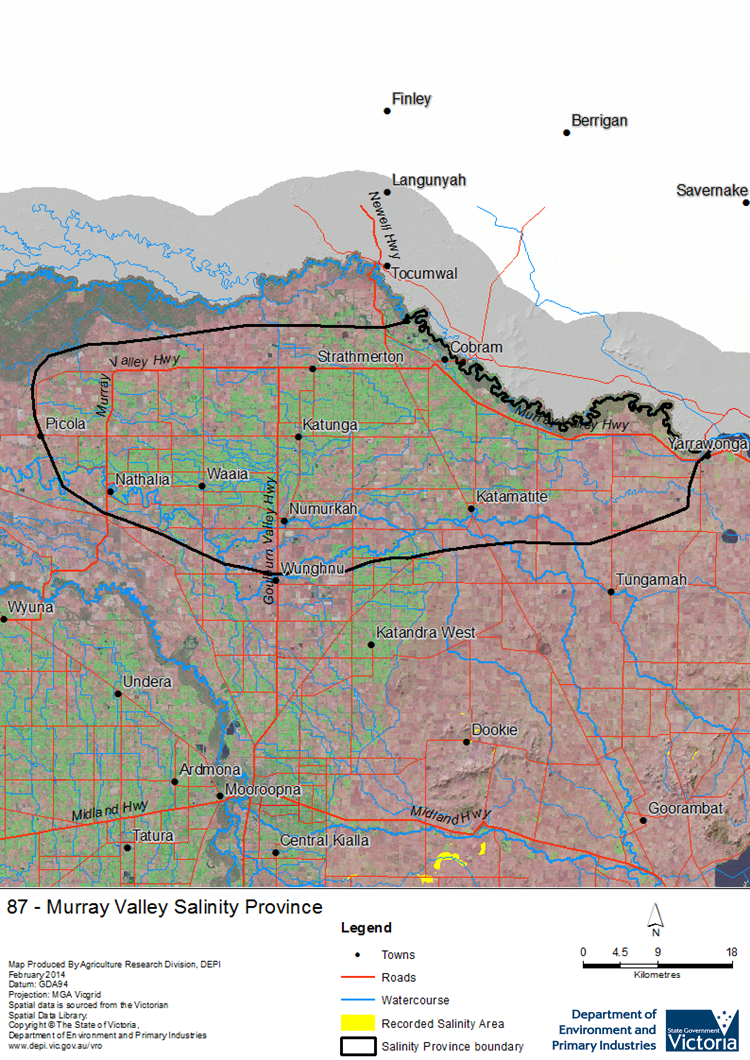
Murray Valley Salinity Province Map

Links to further reading and material related to the Goulburn Broken Salinity Province
For further information relating to groundwater levels and salinities in this Province please see: Visualising Victoria's Groundwater (VVG)
1 Please Note: The ‘Recorded Soil Salinity Area’ indicated in the Salinity Province Attribute Table, comprises the total geographic area that has been mapped as having, or showing symptoms of, dryland soil salinity at some time (past or present). As dryland salinity occurrence in the Victorian landscape exhibits many different levels of severity and can change due to climate, landuse and vegetation, previously mapped areas may no longer be showing symptoms. In addition, as not all parts of the State have been mapped, or mapped in the same way, the mapping may not have captured some occurrences.
The soil salinity mapping used to calculate this ‘area’ does not cover irrigation regions. In irrigation regions, depth to watertable and watertable salinity mapping has been used to convey the threat of high watertables on soil waterlogging and/or soil salinisation and these areas are not included in this ‘area‘ calculation.
Please contact the Department, your Catchment Management Authority or your rural water provider for more information about salinity in your location.

 Salinity in the Murray Valley Salinity Province is primarily associated with the irrigation development on the Riverine Plains. This large province of about 170,000 ha is part of the Shepparton Irrigation Region that uses water diverted from the Murray River at Yarrawonga weir. It is underlain by intermediate to regional scale Groundwater Flow Systems beneath a largely flat landscape. Greatly increased recharge to the Groundwater Flow Systems due to irrigation development, poor surface drainage and the wetter climate phase from the 1950s to 1990s caused the watertable to rise to the surface, causing waterlogging and salinity.
