Salinity Province 72, Merino Tablelands
|
|
Province Attributes
| Catchment Management Region: | GLENELG-HOPKINS |
| Priority Status: | High |
| Province Area: | 219,910 ha |
| Recorded Soil Salinity Area 1: | 811 ha |
| Dominant Surface Geology Type: | Sedimentary |
| Influence of Geological Structure on Salinity Occurrence/s: | None |
| Relevant Geomorphological Mapping Units (GMUs): | 2.3.X, 6.2.1 |
| Predominant Groundwater Flow Systems (GFSs): | Local/Intermediate |
| Relevant Irrigation Areas: | N/A |
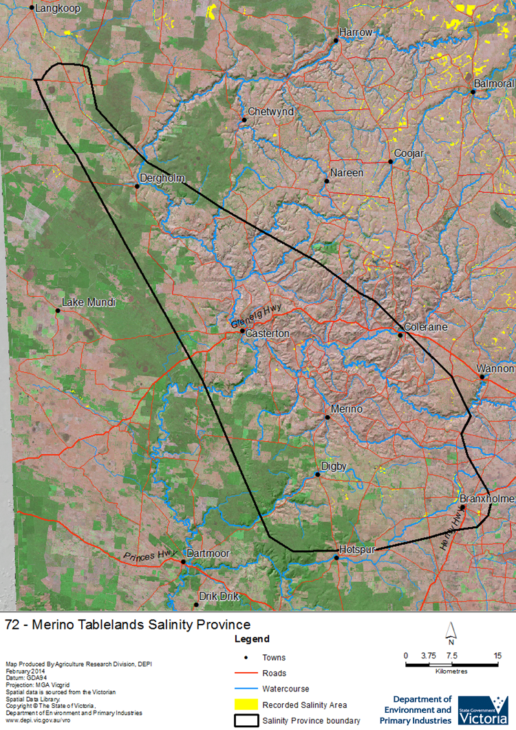
Merino Tablelands Salinity Province Map

Links to further reading and material related to the Glenelg Hopkins Salinity Province
Groundwater Flow Systems (GFS) in the Glenelg Hopkins CMR
For further information relating to groundwater levels and salinities in this Province please see: Visualising Victoria's Groundwater (VVG)
1 Please Note: The ‘Recorded Soil Salinity Area’ indicated in the Salinity Province Attribute Table, comprises the total geographic area that has been mapped as having, or showing symptoms of, dryland soil salinity at some time (past or present). As dryland salinity occurrence in the Victorian landscape exhibits many different levels of severity and can change due to climate, landuse and vegetation, previously mapped areas may no longer be showing symptoms. In addition, as not all parts of the State have been mapped, or mapped in the same way, the mapping may not have captured some occurrences.
The soil salinity mapping used to calculate this ‘area’ does not cover irrigation regions. In irrigation regions, depth to watertable and watertable salinity mapping has been used to convey the threat of high watertables on soil waterlogging and/or soil salinisation and these areas are not included in this ‘area‘ calculation.
Please contact the Department, your Catchment Management Authority or your rural water provider for more information about salinity in your location.

 The large Merino Tablelands Salinity Province is underlain by Cretaceous age sandstone and mudstone rocks of the Otway Group, which are overlain by a deeply weathered regolith and clay soils. Groundwater flow through the deeper fractured rock forms an intermediate scale Groundwater Flow System (GFS) while the regolith provides local scale GFSs whereby brackish groundwater is conveyed to discharge zones along some depressions and drainage lines. Dryland salinity occurrences are predominantly found associated with these drainage lines and depressions, with a few ‘break-of-slope’ occurrences seen at the northern end of the province. Increased groundwater recharge post land clearing has exacerbated high watertables in parts of the province that are naturally prone to waterlogging.
