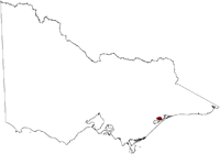
Salinity Province 10, Bengworden
|
|
Province Attributes
| Catchment Management Region: | EAST GIPPSLAND |
| Priority Status: | Low |
| Province Area: | 20,310 ha |
| Recorded Soil Salinity Area 1: | 922 ha |
| Dominant Surface Geology Type: | Sedimentary |
| Influence of Geological Structure on Salinity Occurrence/s: | None |
| Relevant Geomorphological Mapping Units (GMUs): | 7.3.X, 8.4.X |
| Predominant Groundwater Flow Systems (GFSs): | Regional & Local/Intermediate |
| Relevant Irrigation Areas: | N/A |
Bengworden Salinity Province Map

Links to further reading and material related to the East Gippsland Salinity Province
For further information relating to groundwater levels and salinities in this Province please see: Visualising Victoria's Groundwater (VVG)
1 Please Note: The ‘Recorded Soil Salinity Area’ indicated in the Salinity Province Attribute Table, comprises the total geographic area that has been mapped as having, or showing symptoms of, dryland soil salinity at some time (past or present). As dryland salinity occurrence in the Victorian landscape exhibits many different levels of severity and can change due to climate, landuse and vegetation, previously mapped areas may no longer be showing symptoms. In addition, as not all parts of the State have been mapped, or mapped in the same way, the mapping may not have captured some occurrences.
The soil salinity mapping used to calculate this ‘area’ does not cover irrigation regions. In irrigation regions, depth to watertable and watertable salinity mapping has been used to convey the threat of high watertables on soil waterlogging and/or soil salinisation and these areas are not included in this ‘area‘ calculation.
Please contact the Department, your Catchment Management Authority or your rural water provider for more information about salinity in your location.

 The Bengworden Salinity Province covers the East Gippsland CMA's share of the Lake Wellington area. Salinity in this area is primarily associated with coastal influences and the Gippsland Lakes. Occurring on land adjoining the lakes and waterways, soil salinity arises from high watertables caused by its proximity to sea level. Local and intermediate scale Groundwater Flow Systems connect recharge areas with discharge areas where land-use changes have influenced salinity processes.
