
4.2.1 Plains with leveed channels, sometimes source-bordering dunes (Wal Wal, Murtoa, Corkers)
|
Plains with leveed channels occupy much of the land between Glenorchy, Murtoa and Horsham. These prior stream plains comprise a suite of sand plains, floodplains and flats including the Corkers prior stream plains, Barrabool sand plains and Wal Wal prior stream plains soil-landform units. To the south lies the current course of the Wimmera River while to the north, the clays plains with subdued ridges are elevated above these plains. | 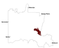 |
Slopes of these plains are gentle in nature with slightly steeper slopes occurring where abutting slopes that lead to clay plains of the north. Soil-landform units are clustered together in areas dominated by the former Murtoa Soldier Settlement (today is part of the Wimmera Irrigation Area). Sediments are Shepparton Formation to Coonambidgal Formation in origin with extensive flooding events leaving a veneer of finer silts and sands deposited within existing prior stream levees and channels.
The channel network is reflected in the soil pattern. Within the Wimmera Trench this area has the greatest soil complexity in the number of classified soil types and particularly in their distribution. Six soil types representing self-mulching, epipedal and massive grey Vertosols, red Vertosols, and red and brown Sodosols occur in the unit. In terms of area occupied, grey Vertosols are the typical soils of the relatively level areas between watercourses. Red and brown Sodosols are the main soils of the levees and occasional slight rises.
Most of the remnant vegetation is woodlands including Low Rises Woodland, Heathy Woodland, Sand Ridge Woodland, Riverine Chenopod Woodland, Plains Woodland, Shallow Sands Woodland and Riparian Woodland. Other vegetation types include Red Gum Wetland, Plains Riparian Shrubby Woodland, Sedge Wetland, Plains Grassland and Freshwater Meadow.
Although little native vegetation remains grey box, buloke, yellow gum and black box all occur singly and occasionally in small stands of these woodlands, grasslands and meadows. Original Plains Grassland vegetation may have included areas of spear grass and wallaby grass.
Factors which could adversely affect agricultural enterprises include landform position, properties of individual soil types and distribution of soil types. With the exception of the current course of the Wimmera River, this landform together with the plain immediately south of the river is the lowest lying area in the Wimmera Trench and as such is subject to occasional extensive flooding which would significantly reduce crop yields. Soil physical properties, such as a hardsetting surface condition on some Sodosols and possibly higher dry bulk densities in some Vertosols, and chemical properties, including high sodicity in deep subsoil, may also indirectly adversely effect crop yield. Diverse physical properties (e.g. the self-mulching condition of Longrenong clay soil type and the massive condition of Murtoa clay soil type) makes cost-effective treatment of the massive surface difficult when these soils situated closely together.
Soil-landform unit | Unit description | Area (km2) |
| Barrabool sand plains | Sand plain | 45 |
| Horsham lake and lunettes | Lake and lunette | 1 |
| Kalkee plains2 | Gently undulating plains | 22 |
| Longerenong prior stream plains | Prior stream | 113 |
| Lubeck alluvial plains | Alluvial plain / floodplains | 44 |
| Murtoa flats | Black box flats | 8 |
| Wal Wal prior stream plains | Prior stream floodplain | 219 |
© State of Victoria (Agriculture Victoria) 1996 - .

This work, Victorian Resources Online, is licensed under a Creative Commons Attribution 4.0 licence. You are free to re-use the work under that licence, on the condition that you credit the State of Victoria (Agriculture Victoria) as author, indicate if changes were made and comply with the other licence terms.
The licence does not apply to ‘branding’ or some ‘images or photographs’ that may be owned by third parties. We ask you to seek prior approval to use images using the VRO feedback form. Access to higher quality images can also be provided on request.
This page was last updated on .