
Soil/Landform Unit - Lubeck alluvial plains
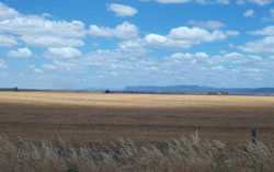 Plains near Lubeck with the Grampians Ranges in the distance |
0.19% of CMA region Running from Lubeck to Glenorchy, this alluvial plain unit constitutes part of the plains with leveed channels of the older alluvial plains (4.2.1). Including gently undulating plains, drainage depressions and alluvial flats, soils of this unit are mainly cracking and self-mulching clay soils (Vertosols) that are generally used fro cereal cropping. Areas within these plains would be vulnerable to flooding and seasonal inundation especially during wet years. The three main remnant native vegetation communities found are Red Gum Wetland, Drainage-line Woodland and Plains Woodland. | 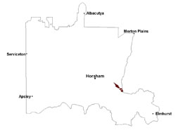 |
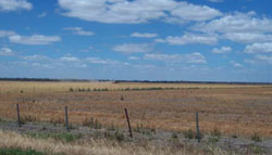
 Cereal stubble near Lubeck | 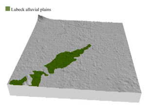 |
 |  Near level plains used for cerel and pasture production |
Component | 1 | 2 | 3 | 4 |
Proportion of soil-landform unit | 15% | 70% | 10% | 5% |
| CLIMATE Rainfall (mm) | Annual: 485 | |||
| Temperature (oC) | Minimum 8, Maximum 21 | |||
| Precipitation less than potential evapotranspiration | September–April | |||
| GEOLOGY Age and lithology | Quaternary fluvial silt, sand and gravel; Neogene marine sand and silt (Parilla Sand) | |||
| Geomorphology | ||||
| LANDUSE | Uncleared areas: Nature conservation Cleared areas: Dryland cropping; sheep grazing | |||
| TOPOGRAPHY Landscape | Alluvial plain and floodplain | |||
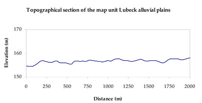
| Elevation range (m) | 143–176 | |||
| Local relief (m) | 1–2 | |||
| Drainage pattern | Dendritic | |||
| Drainage density (km/km2) | 0.2 | |||
| Landform | Gently undulating plains | Alluvial plains | Drainage depressions | |
| Landform element | Gentle slope | Plain | Alluvial flat | Drainage line |
| Slope and range (%) | 2 (1-4) | 1 (0-3) | 0 (0-1) | 0 (0-1) |
| Slope shape | Linear | Straight | Straight | Concave |
| NATIVE VEGETATION Ecological Vegetation Class | Plains Woodland (76.5%), Drainage-line Woodland (7.3%), Red Gum Wetland (4.4%) | |||
| SOIL Parent material | Marine sand and silt | Fluvial gravel, sand and silt, marine sand and silt | Fluvial gravel, sand and silt | Alluvial gravel, sand and silt |
| Description (Corangamite Soil Group) | Cracking and self-mulching clay soils (24) | Cracking clay soils (23) | Cracking clay soils (23) | Cracking clay soils (23) |
| Soil type sites | ||||
| Surface texture | Medium clay | Light clay | Light clay to medium clay | Light clay to medium clay |
| Permeability | Slow | Very slow | Very slow | Very slow |
| Depth (m) | > 3 | > 2 | > 2 | > 2 |
| LAND CHARACTERISTICS, POTENTIAL AND LIMITATIONS Critical land features, processes, forms | Gentle slopes can be prone to periodic waterlogging, but can be variable due to micro relief (gilgai). Surface soils friable and only slightly susceptible to wind erosion. Soils may be susceptible to compaction at critical moisture contents. | Plains can be susceptible to inundation and waterlogging. Surface soils generally not friable and are susceptible to compaction (less structure). | Flats are susceptible to inundation from flooding and waterlogging. Surface soils generally not friable and are susceptible to compaction (less structure). | Drainage lines are extremely susceptible to inundation from flooding and waterlogging. Soil permeability is very slow. Surface soils generally not friable and are susceptible to compaction (less structure). |
© State of Victoria (Agriculture Victoria) 1996 - .

This work, Victorian Resources Online, is licensed under a Creative Commons Attribution 4.0 licence. You are free to re-use the work under that licence, on the condition that you credit the State of Victoria (Agriculture Victoria) as author, indicate if changes were made and comply with the other licence terms.
The licence does not apply to ‘branding’ or some ‘images or photographs’ that may be owned by third parties. We ask you to seek prior approval to use images using the VRO feedback form. Access to higher quality images can also be provided on request.
This page was last updated on .