
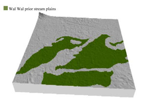
Soil/Landform Unit - Wal Wal prior stream plains
Landform Unit Description
Page top
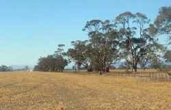 Level clay plains near Lubeck |
0.93% of CMA region This prior stream plains unit is found north of Glenorchy on the eastern border of the Wimmera CMA. This plains complex with leveed channels is part of the Northern Riverine Plains older alluvial plains (4.2) geomorphological unit. The Quaternary alluvial sediments lie adjacent to the major stream units of the Wimmera River, Yariambiack Creek and Dunmunkle Creek, clay plains and higher residual sand plains. There are four components, the level plains are dominant and flats sub-dominant. The other components are gentle slopes and drainage lines. Soil types include cracking clay soils with limited self-mulching surfaces (Vertosols) and some red sodic texture contrast soils (Sodosols) on slight rises (levees). Periodic inundation and waterlogging occur on extensive flat areas and depressions. This unit is used for dryland cropping and grazing (sheep, beef cattle). Remnant vegetation is largely either Plains Grassland or Plains Woodland. | 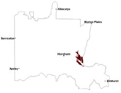 |
 |  |
Component | 1 | 2 | 3 | 4 |
Proportion of soil-landform unit | 55% | 15% | 25% | 5% |
| CLIMATE Rainfall (mm) | Annual: 470 | |||
| Temperature (oC) | Minimum 8, Maximum 21 | |||
| Precipitation less than potential evapotranspiration | September–April | |||
| GEOLOGY Age and lithology | Quaternary fluvial silt, sand and minor gravel (Shepparton Formation); Neogene marine sand and silt (Parilla Sand); Quaternary fluvial gravel, sand and silt | |||
| Geomorphology | ||||
| LANDUSE | Uncleared areas: water supply; nature conservation Cleared areas: dryland cropping; sheep and beef cattle grazing | |||
| TOPOGRAPHY Landscape | Prior stream floodplain | |||
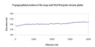
| Elevation range (m) | 131–181 | |||
| Local relief (m) | 1–2 | |||
| Drainage pattern | Dendritic | |||
| Drainage density (km/km2) | 0.6 | |||
| Landform | Plains | Prior streams | ||
| Landform element | Level plain | Gentle slope | Alluvial flat | Drainage line |
| Slope and range (%) | 0 (0-1) | 1 (0-3) | 0 (0-1) | 0 (0-1) |
| Slope shape | Straight | Linear | Straight | Concave |
| NATIVE VEGETATION Ecological Vegetation Class | Plains Woodland (77.3%), Plains Grassland (19.0%) | |||
| SOIL Parent material | Fluvial gravel, sand and silt | Marine sand and silt | Fluvial gravel, sand and silt | Fluvial gravel, sand and silt |
| Description (Corangamite Soil Group) | Cracking clay soils (23) | Cracking clay soils (23) | Cracking clay soils (23) | |
| Soil type sites | ||||
| Surface texture | Light clay | Sandy loam to light clay | Light clay | Light clay |
| Permeability | Slow | Slow to moderate | Very slow | Very slow |
| Depth (m) | > 2 | > 2 | > 2 | > 2 |
| LAND CHARACTERISTICS, POTENTIAL AND LIMITATIONS Critical land features, processes, forms | Flat areas susceptible to inundation and waterlogging, but can be variable locally due to micro relief (gilgai). Surface soils generally not friable but are susceptible to compaction (less structure). | Soils may be slightly susceptible to inundation and waterlogging where surface soil is shallow. Hardsetting soil slightly susceptible to sheet and rill erosion. Soils are prone to compaction at critical moisture contents. Slight susceptibility to acidification of surface soil. | Flats are susceptible to inundation and waterlogging along with flooding. Surface soils generally not friable and are susceptible to compaction (less structure). | Drainage depressions are subject to seasonal inundation, waterlogging and flooding. Surface soils generally not friable and are susceptible to compaction (less structure). |
© State of Victoria (Agriculture Victoria) 1996 - .

This work, Victorian Resources Online, is licensed under a Creative Commons Attribution 4.0 licence. You are free to re-use the work under that licence, on the condition that you credit the State of Victoria (Agriculture Victoria) as author, indicate if changes were made and comply with the other licence terms.
The licence does not apply to ‘branding’ or some ‘images or photographs’ that may be owned by third parties. We ask you to seek prior approval to use images using the VRO feedback form. Access to higher quality images can also be provided on request.
This page was last updated on .