
Soil/Landform Unit - Barrabool sand plains
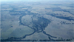
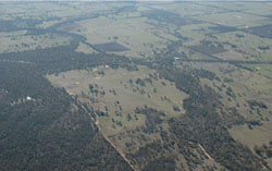 Mount William Creek floodplain near Dadswell Bridge. Plains north of Dadswell Bridge (north of Western Hwy – running through centre of photo) are flood out sand plains |
0.52% of CMA region The Barrabool sand plains soil-landform unit is situated in the east of the catchment surrounding the Wimmera River near Dadswell Bridge and further west where associated with MacKenzie Creek. The plains represent residual surfaces of a once slightly higher landscape and may indeed represent plains coating underlying Neogene sediments (Parilla Sand). The unit is relatively segmented and represents geomorphic processes akin to older alluvial plains with leveed channels (4.2.1). Sodic red texture contrast soils and sandy variants are common on plains with cracking clay prevalent in drainage depressions that supply waters to the Wimmera River, but also receive waters during flooding events. As a result, soils may be susceptible to periodic waterlogging in addition to compaction of hardsetting surface soils. Remnant vegetation includes a suite of woodland structures with other vegetation types including Red Gum Wetland, Sedge Wetland and Plains Grassland. | 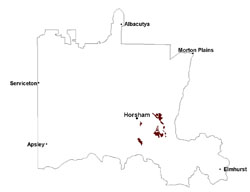 |
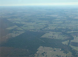 Sand plains west of Mt William Creek (Lake Tavlor in distance) | 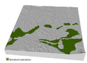 |
|
|
Component | 1 | 2 |
Proportion of soil-landform unit | 85% | 15% |
| CLIMATE Rainfall (mm) | Annual: 505 | |
| Temperature (oC) | Minimum 8, Maximum 21 | |
| Precipitation less than potential evapotranspiration | September–April | |
| GEOLOGY Age and lithology | Quaternary fluvial sand, silt and minor gravel (Shepparton Formation); Neogene marine sand and silt (Parilla Sand); Quaternary fluvial gravel, sand and silt | |
| Geomorphology | ||
| LANDUSE | Uncleared areas: nature conservation Cleared areas: dryland cropping; sheep grazing | |
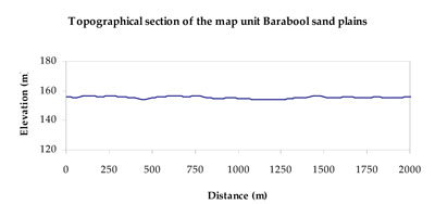
| TOPOGRAPHY Landscape | Sand plains | |
| Elevation range (m) | 128–174 | |
| Local relief (m) | 3-5 | |
| Drainage pattern | Convergent (anabranch) | |
| Drainage density (km/km2) | 0.5 | |
| Landform | Sand plains | |
| Landform element | Sand plain | Drainage depression |
| Slope and range (%) | 1 (0-5) | 1 (0-1) |
| Slope shape | Straight | Straight |
| NATIVE VEGETATION Ecological Vegetation Class | Low Rises Woodland (26.1%), Shallow Sands Woodland (15.9%), Plains Woodland (15.0%), Plains Grassland (8.9%), Other (31.7%) | |
| SOIL Parent material | Fluvial sand, silt and gravel | Fluvial sand, silt and minor gravel |
| Description (Corangamite Soil Group) | Sodic red texture contrast soils (25) | Cracking clay soils (23) and sodic red texture contrast soils (25) |
| Soil type sites | ||
| Surface texture | Fine sandy loam | Fine sandy loam to light clay |
| Permeability | Slow | Very slow |
| Depth (m) | > 2 | > 2 |
| LAND CHARACTERISTICS, POTENTIAL AND LIMITATIONS Critical land features, processes, forms | Soils may be slightly susceptible to inundation and waterlogging where surface soil is shallow. Hardsetting soil slightly susceptible to sheet and rill erosion. Soils are prone to compaction at critical moisture contents. Subsoil susceptible to gully erosion when exposed due to dispersive (sodic) nature. Slight susceptibility to acidification of surface soil. | Flat areas susceptible to inundation and waterlogging, but can be variable locally due to micro relief (gilgai). Surface soils generally not friable and are susceptible to compaction (less structure). |
© State of Victoria (Agriculture Victoria) 1996 - .

This work, Victorian Resources Online, is licensed under a Creative Commons Attribution 4.0 licence. You are free to re-use the work under that licence, on the condition that you credit the State of Victoria (Agriculture Victoria) as author, indicate if changes were made and comply with the other licence terms.
The licence does not apply to ‘branding’ or some ‘images or photographs’ that may be owned by third parties. We ask you to seek prior approval to use images using the VRO feedback form. Access to higher quality images can also be provided on request.
This page was last updated on .