
1.2 Landscapes above 500 m of low relief
- 1.2.1 Plateaux and broad ridges (Straghbogie, Koetong-Shelly, Errinundra, Kinglake, Olinda)
- 1.2.2 Enclosed landscapes of low relief (Fraser Tableland, Benambra)
1. Eastern Uplands (EU)
1.2.1 Plateaux and broad ridges (Straghbogie, Koetong-Shelly, Errinundra, Kinglake, Olinda)
1.2.2 Enclosed landscapes of low relief (Fraser Tableland, Benambra)
| These landscapes appear to be generally of similar age to those described in Tier 1.1 but occur at intermediate elevations (500-1200 m). They are generally characterised by undulating to low hilly areas and low-gradient streams. On the northern side of the Great Divide, the Tawanga fault has created an abrupt termination of the Kiewa valley landscape at Tawonga, and a major break between Tiers 1.1 and 1.2. The Koetong-Shelly plateau and the Strathbogie tablelands at elevations about 600 – 1 100 m are formed on granite. The Beechworth - Stanley uplands (600 – 700 m) are partly granitic and partly Palaeozoic sediments, the latter also having areas of late Tertiary alluvium which have been sluiced for alluvial gold. The Wabonga and Toombullup uplands are separated by the deeply incised valley of the King River. The former occurs on relatively flat bedded non-marine Carboniferous sediments that overlie the Devonian acid volcanic rocks that form the plateau surface of the latter. There are numerous small basaltic residuals on the Toombullup surface. There are also numerous broad ridges that appear to represent the same surface but lack width because of encroachment of the steep slopes of the major drainage systems. | 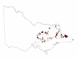 |
South of the Great Divide, an extensive lower level dissected planar landscape can be recognized. It begins as a platform below and surrounding the Dandenong Range at Mitcham and Wandin and extends eastwards as a variable undulating surface of low relief as the initial stage of the Eastern Uplands bordering the Eastern Plains (Tier 7). This is named the Nillumbik Terrain. It can be traced as far east as Bairnsdale, and may extend further east as gravel capped flattened spurs fringing the highlands. The basalt-covered tableland at Neerim South and the Moondarra Plateau north-west of Traralgon are part of it. The Nillumbik Terrain is cut in a variety of rock types and generally displays considerable weathering.
North of the Great Divide the most widespread vegetation is tall to low open forest of mixed eucalypt species (e.g. Narrow-leaf and Broad-leaf Peppermint, Candlebark Gum, Manna Gum, Victorian Blue Gum). In drier areas Red Stringybark and Red Box become more dominant. South of the Great Divide the eucalypt species are even more varied and include Ironbarks near Glenmaggie.
The soils on these surfaces are formed in deeply weathered regolith, including areas of late Tertiary alluvium. The soils are mainly red or brown gradational soils (Dermosols).
Related information on VRO
- A Study of the Land in the Catchment of the Kiewa River (R K Rowe 1972)
- A Study of the Land in the Buffalo National Park (R K Rowe 1970)
- A Study of the Land in the Upper Ovens and King Rivers ( R K Rowe 1952)
- A Study of the Land in the Victorian Catchment of Lake Hume (R K Rowe 1967)
- A Study of the Land in the Catchment of Gippsland Lakes, Volume 1 (J M Aldrick 1988)
- A Study of the Land in the Catchment of Gippsland Lakes, Volume 2 (J M Aldrick 1988)
- Land Inventory of East Gippsland - A Reconnaissance Survey Technical Report No. 23 (D B Rees, 1996)
- A Study of the Land in the Catchment of Lake Eildon (A S Rundle 1977)
- Land Resource Assessment in the Western part of the Shire of Towong (R Hook and D Rees 1999)
- A Study of the Land in the Catchment of the Broken River (A S Rune and R K Rowe 1974)
- Reconnaissance Survey of the Middle Reaches of the Goulburn River Catchment (Edited by L A White 1990)
© State of Victoria (Agriculture Victoria) 1996 - .

This work, Victorian Resources Online, is licensed under a Creative Commons Attribution 4.0 licence. You are free to re-use the work under that licence, on the condition that you credit the State of Victoria (Agriculture Victoria) as author, indicate if changes were made and comply with the other licence terms.
The licence does not apply to ‘branding’ or some ‘images or photographs’ that may be owned by third parties. We ask you to seek prior approval to use images using the VRO feedback form. Access to higher quality images can also be provided on request.
This page was last updated on .