
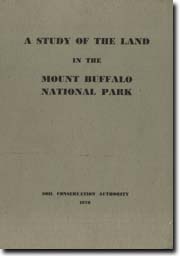
A Study of the Land in the Mount Buffalo National Park
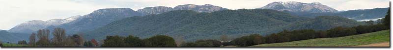 View of Mt Buffalo from Porepunkah. |
This land study was carried out by Ken Rowe of the former Soil Conservation Authority (SCA) in the late 1960s and published in 1970. It aimed to provide basic information that would assist the then National Parks Authority plan and manage the Mount Buffalo National Park.
To view the information PDF requires the use of a PDF reader. This can be installed for free from the Adobe website.
The Land Units
| Land Unit 1 - Basins on granite (PDF 1.4MB) | Land Unit 2 - Basins on sedimentary rocks (PDF 453KB) |
| Land Unit 3 - Hills at high elevations on granite, very rocky (PDF 755KB) | Land Unit 4 - Hills at high elevations on granite, not very rocky (PDF 465KB) |
| Land Unit 5 - Hills at intermediate elevations on sedimentary rocks (PDF 457KB) | Land Unit 6 - Slopes of granite, very rocky (PDF 522KB) |
| Land Unit 7 - Slopes of granite, not very rocky (PDF 597KB) | Land Unit 8 - Slopes of sedimentary rocks (PDF 629KB) |
| Land Unit 9 - High-valley plains (PDF 903KB) |
 | Front Page, Table of Contents, Preface and Summary (PDF 431KB) | |
| Introduction (PDF 379KB) - The Area - Reasons for the Study | ||
| The Environment (PDF 1.3MB) - Climate - Geology - Topography - Vegetation - Vegetative Communities - Fauna | ||
| Land Use (PDF 833KB) - Land Use Past and Present - Present Condition of the Park - A Classification of National Parks | ||
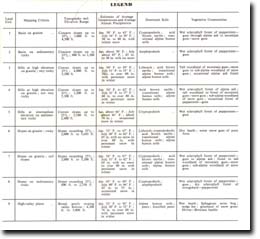
| The Environmental Patterns - Ecology basis of Mapping Units, and the Methods Used (PDF 113KB) - The Principles - The Methods - The Land Units (Refer to individual listing above for specific land units) | ||
| Conclusions (PDF 116KB) | ||
| Acknowledgments (PDF 313KB) | ||
| References (PDF 313KB) | ||
| Appendices (PDF 313KB) |
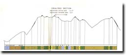
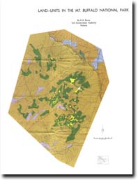 Land Units in the Mount Buffalo National Park (PDF 1.3MB) |
© State of Victoria (Agriculture Victoria) 1996 - 2025.

This work, Victorian Resources Online, is licensed under a Creative Commons Attribution 4.0 licence. You are free to re-use the work under that licence, on the condition that you credit the State of Victoria (Agriculture Victoria) as author, indicate if changes were made and comply with the other licence terms.
The licence does not apply to ‘branding’ or some ‘images or photographs’ that may be owned by third parties. We ask you to seek prior approval to use images using the VRO feedback form. Access to higher quality images can also be provided on request.
This page was last updated on 25/01/2019.