
GL169
| Site: GL169 | Land Unit: Ararat Alluvial |
| Aust. Soil Class.: Eutrophic, Mottled-Subnatric, Grey SODOSOL (confidence level 1) | |
 | General Land Unit Description: This soil represents the alluvial plains in the north east of the study area around Ararat and Moyston. The soils tend to be Black or Grey Sodosols, Vertosols or Vertic Chromosols. They are generally imperfectly drained and have very little relief. |
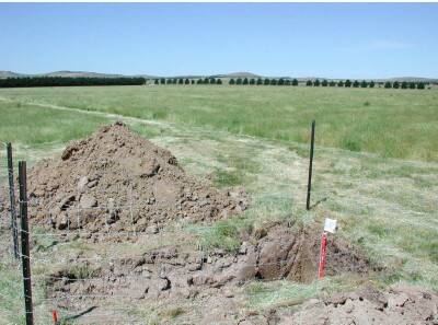
Site Description:
| Slope: <1% | Geology: Quaternary Alluvium |
| Landform pattern: Level to gently undulating plain | Position in landscape: Flat |
| Internal drainage: Imperfect to poorly drained |
Soil Profile Morphology
| A1 | 0-15 cm | Dark greyish brown (10YR4/2) clay loam, strong polyhedral structure (5-10 mm), weak consistence when dry, a few small rounded pebbles (2-6 mm), pH 5.3; clear transition to: | 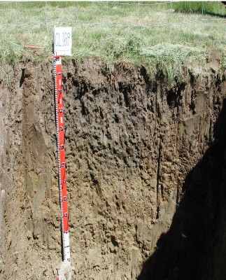 |
| Subsoil | |||
| B21 | 15-40 cm | Dark grey (10YR4/1) heavy clay, distinct fine brownish yellow (10YR6/6) mottles are common, strong prismatic (50-100 mm) to moderate polyhedral structure (5-10 mm), very firm consistence when dry, pH7.3; clear and wavy transition to: | |
| B22 | 40-60 cm | Greyish brown (2.5Y5/2) heavy clay, fine faint yellow mottles (10YR7/6) are common, pH 8.4; gradual and wavy transition to: | |
| B23 | 60-90 cm | Light olive brown (2.5Y5/4) heavy clay, distinct medium yellowish brown (10YR5/6) mottles are common, moderate angular structure, very firm consistence when dry, pH 9.1; gradual and wavy transition to: | |
| B24 | 90+ cm | Light yellowish brown (2.5Y3/6) heavy clay, pH 9.5. |
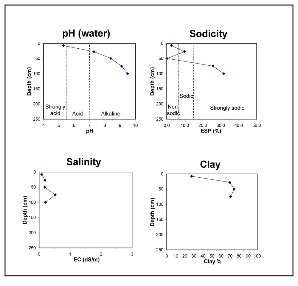
Key profile features:
- Acidic topsoil
- Topsoil dispersive when worked when wet
- Strongly dispersive subsoil when dry
- Sodic subsoil
- Deeper subsoil highly alkaline
- Mottled subsoil
© State of Victoria (Agriculture Victoria) 1996 - 2025.

This work, Victorian Resources Online, is licensed under a Creative Commons Attribution 4.0 licence. You are free to re-use the work under that licence, on the condition that you credit the State of Victoria (Agriculture Victoria) as author, indicate if changes were made and comply with the other licence terms.
The licence does not apply to ‘branding’ or some ‘images or photographs’ that may be owned by third parties. We ask you to seek prior approval to use images using the VRO feedback form. Access to higher quality images can also be provided on request.
This page was last updated on 23/03/2020.