GL167
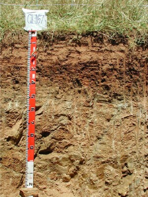
Australian Soil Classification: Mottled, Eutrophic, Brown CHROMOSOL (confidence level 1)
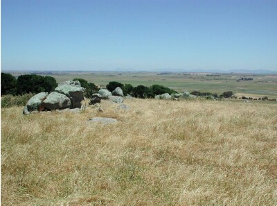
General Landscape Description: Low hills.
Site Description: Just off crest.
Land Unit: Ararat Granites.
Geology: Ordovician granite.
General Land Unit Description: This land unit consists of granitic hills and rises around Ararat. Granitic tors are common on the crests and at the break of slope in some areas. Landslips are evident on the steeper slopes. This site is situated just off the crest of a low hill. The crest itself has a large amount of large granite tors. The soils are generally shallow (less than 50 cm deep) with a sharp transition to a deep weathered C horizon. Granite floaters may occur at varying depths. The subsoil structure is very prismatic and angular. The dominant soil type is a Grey Sodosol, often found on the lower slopes, (GL168, GL174). Chromosols are more likely to occur on the crests and steeper slopes. Due to the high amounts of rock outcrop at this site, it will have a lower land capability rating than GL168.

Soil Profile Morphology:
Horizon | Depth (cm) | |||
A11 | 0–15 | Very dusky red (2.5YR2.5/2); loamy coarse sand; weak fine subangular blocky structure; very weak consistence; contains many fine gravely subrounded quartz; pH 6.2; gradual change to: |  | |
A12 | 15–25 | Reddish brown (5YR4/4), with many medium prominent dark yellowish brown (10YR3/6) mottles; loamy coarse sand; weak medium subangular blocky structure; contains many fine subrounded quartz pebbles; pH 5.7; abrupt change to: | ||
B2 | 25–40 | Reddish brown (2.5YR5/3), with, many prominent medium dark yellowish brown (10YR3/6) mottles; medium heavy clay; strong fine prismatic parting to strong medium angular blocky structure; many distinct clay skins present; pH 6.6; clear and wavy change to: | ||
C | 40–120+ | Weathered granite | ||
pH | Salinity Rating | |||
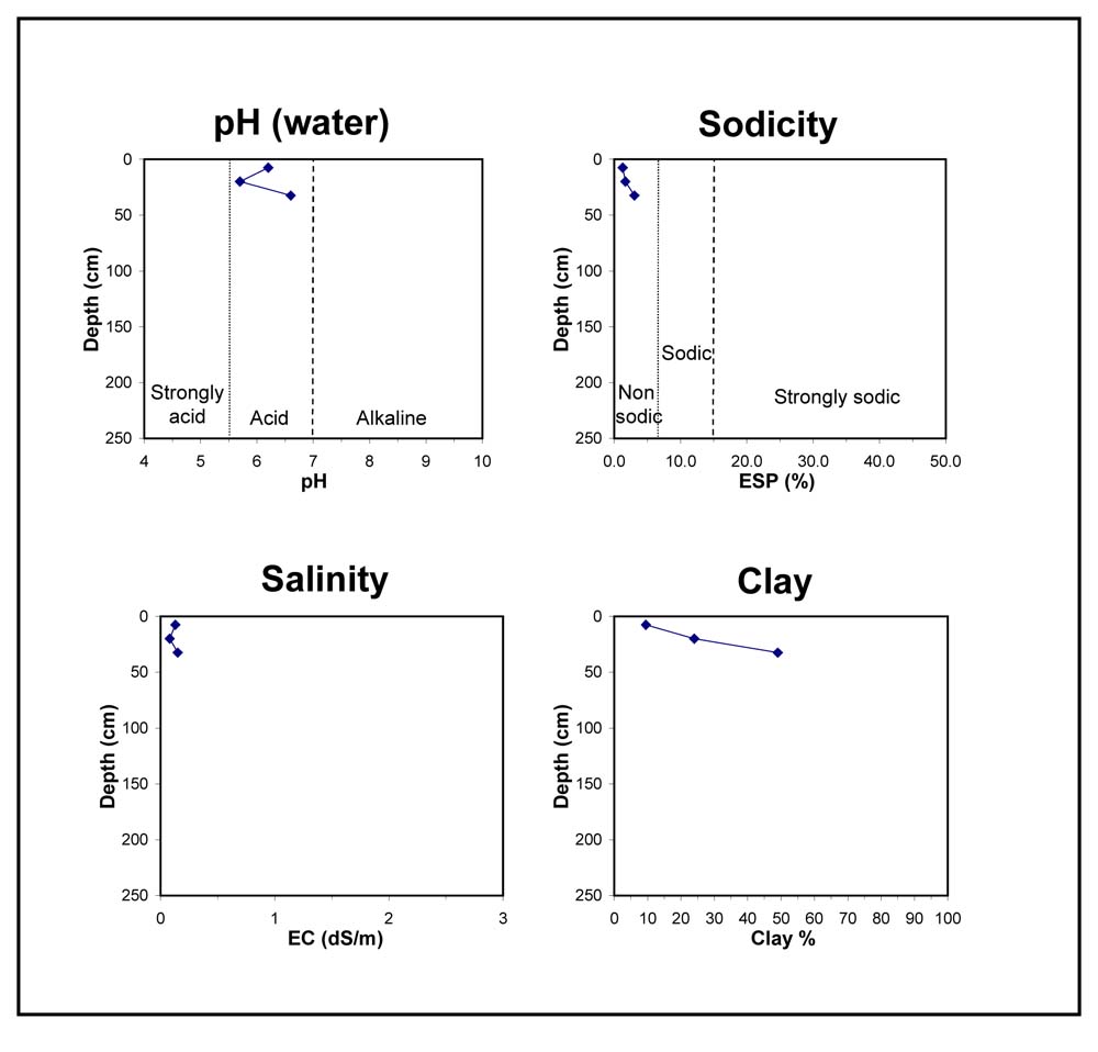
Surface (A11 horizon) | Slightly Acid | Low | Non-sodic | None |
Subsoil (25-40 cm) | Slightly Acid | Low | Non-sodic | None1 |
 |
Horizon | Horizon Depth (cm) | pH (water) | pH (CaCl2) | EC dS/m | Organic Carbon % | Total Nitrogen % | Exchangeable Aluminium ppm | Exchangeable Acididty meq/100g | Exchangeable Cations | Coarse Sand (0.2-2.0 mm) % | Fine Sand (0.02-0.2 mm) % | Silt (0.002-0.02 mm) % | Clay (<0.002 mm) % | Field Capacity % w/w | Wilting Point % w/w | |||
Ca | Mg | K | Na | |||||||||||||||
meq/100g | ||||||||||||||||||
A11 | 0-15 | 6.2 | 5.4 | 0.13 | 2 | 0.2 | <10 | 5 | 2.9 | 0.91 | 1.2 | 0.13 | 49 | 31 | 7 | 10 | 12.6 | 5 |
A12 | 15-25 | 5.7 | 4.7 | 0.08 | 19 | 5.9 | 2.2 | 1.7 | 1.4 | 0.19 | 38 | 29 | 7 | 24 | 14 | 7.5 | ||
B2 | 25-40 | 6.6 | 5.9 | 0.15 | 6.4 | 4.6 | 6.6 | 1.9 | 0.62 | 23 | 21 | 6 | 49 | 25 | 15.6 | |||
Key Profile Features:
- Shallow soil profile
- Mottled subsoil
- Many coarse fragments above B horizon
- Subsoil dispersive when worked when wet
Profile Described By: David Rees, December 2002.


