Your gateway to a wide range of natural resources information and associated maps

Victorian Resources Online

Land Classing kit for Farmers

This booklet was prepared by Nathalie Baxter of the former Department of Natural Resources and Environment, Agriculture Victoria in January 2000. The booklet aims to help farmers identify the limitations of the land and soil in a systematic and rational way. Land classing is a fundamental step in developing a Whole Farm Plan. By identifying areas with similar land and soil types, landholders are better able to make informed decisions on what land use is suited to a certain area. Land classing determines land and soil with similar agricultural potential and similar management requirements.

To view the information PDF requires the use of a PDF reader. This can be installed for free from the Adobe website (external link).

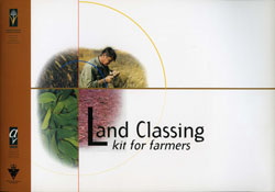


Land Classing kit for farmers
Front page, Table of Contents, Disclaimer (PDF 880KB)
Introduction
Land classing kit for farmers
Summary of the steps involved in land classing
Land classing principles
What do I do with the land classes?
Materials for getting started
How do I use this booklet?
What do the land classes mean? (PDF 2.5MB)

Gathering general information about your property
Step 1 - Establishing your Land Degradation Hazard Region (PDF 3.0MB)
Step 2 - Identifying non-agricultural land (PDF 1.5MB)
Step 3 - Determining you slope classes (PDF 1.6MB)
Step 4 - Do I have arable or non-arable land? (PDF 1.5MB)

Determining the non-arable land classes
Step 5 - Determining the percentage of rock outcrop and surface stone (PDF 1.8MB)
Step 6 - Determining total soil depth (PDF 1.7MB)
Step 7 - Identifying the topsoil colour (PDF 1.5MB)
Step 8 - Identifying soil drainage (PDF 1.7MB)

Determining the arable land classes
Step 9 - Establishing landscape types (PDF 1.8MB)
Step 10 - Determining topsoil depth (PDF 1.8MB)
Step 11 - Determining topsoil structure (PDF 2.0MB)

Appendix A (PDF 614KB)

Appendix B (PDF 516KB)

Clinometer Instructions (PDF 2.0MB)
Page top