
Horticulture Land Use 1944
Back to: Victorian Horticulture Homepage
In 1944 the State Regional Boundaries Committee produced an Atlas of maps covering Victoria's Land Use, Population and Natural Resources. This map shows the areas under market gardens and crops such as potatoes and maize in 1944. Also shown are locations of associated factories. These maps were developed from often limited information but provide an important historical perspective, showing areas where certain land uses occurred over 70 years ago.
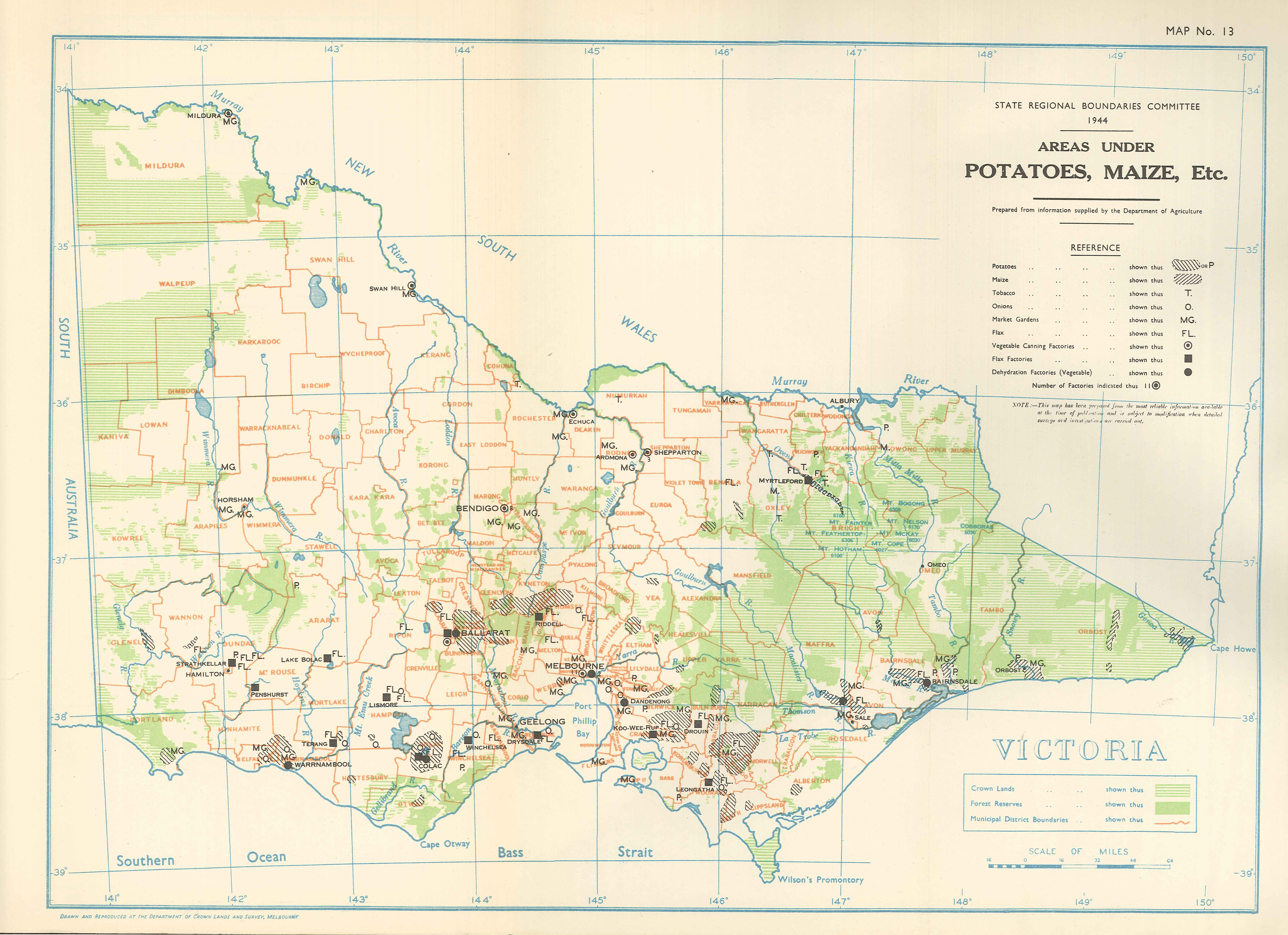
Areas under Potatoes, Maize, Etc. 1944
© State of Victoria (Agriculture Victoria) 1996 - 2025.

This work, Victorian Resources Online, is licensed under a Creative Commons Attribution 4.0 licence. You are free to re-use the work under that licence, on the condition that you credit the State of Victoria (Agriculture Victoria) as author, indicate if changes were made and comply with the other licence terms.
The licence does not apply to ‘branding’ or some ‘images or photographs’ that may be owned by third parties. We ask you to seek prior approval to use images using the VRO feedback form. Access to higher quality images can also be provided on request.
This page was last updated on 23/03/2020.