
MM670
| Site: MM670 | Land Unit: Stony Rises |
| Aust. Soil Class.: ?, Ferric-Petroferric, Leptic RUDOSOL (confidence level 4) | |
| General Land Unit Description: This land unit consists of the ‘stony rise’ country that occurs throughout the basalt plains. The unit consists of an irregular surface of widespread basalt lava flows in which hummocks, depressions, ridges and blind channels have given a completely confused topography, with a relief usually of about 10 metres. The soils of the gently undulating stony mounds or ‘stony rises’ are shallow red or black loamy soils (Rudosols, shallow Dermosols) which also occur on the stony areas between rises. Black Vertosols occupy the numerous swamps and depressions between the rises and the crests of the relatively lower and broader rises that may be less rocky. Very little open country is found amongst the rises, but where it does occur the soils are usually Ferric Brown Chromosols. |
Site Description:
| Geology: Quaternary basalt | Landform pattern: Gently undulating plain |
| Position in landscape: Crest | Internal drainage: Imperfectly drained |
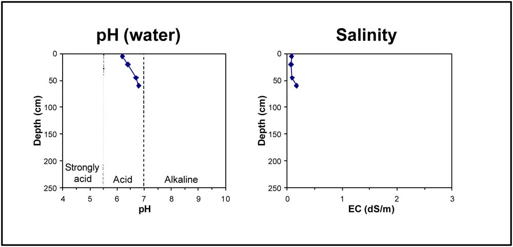
Soil Profile Morphology
| A11 | 0-30 cm | Black, very dark brown and dark reddish brown clay loam to loam, moderate to strong consistence when dry, weak to massive structure, variable amounts of coarse fragments, transition to: |
| A12 | 30 cm | Black, very dark brown and dark reddish brown clay loam-loam, moderate to strong consistence when dry, firm to weak structure, coarse fragments and ferromanganiferous nodules are abundant, carbonate nodules especially evident in alkaline profiles. |
| Rock | 30+ cm |
Key profile features:
- Shallow soil
- Calcium carbonate nodules in some profiles
- Coarse fragments
- Ferric horizon in some profiles
© State of Victoria (Agriculture Victoria) 1996 - 2025.

This work, Victorian Resources Online, is licensed under a Creative Commons Attribution 4.0 licence. You are free to re-use the work under that licence, on the condition that you credit the State of Victoria (Agriculture Victoria) as author, indicate if changes were made and comply with the other licence terms.
The licence does not apply to ‘branding’ or some ‘images or photographs’ that may be owned by third parties. We ask you to seek prior approval to use images using the VRO feedback form. Access to higher quality images can also be provided on request.
This page was last updated on 23/03/2020.