
IT6
| Site: IT6 | Land Unit: Glenelg River Granites |
| Aust. Soil Class.: Basic, Petroferric, Orthic TENOSOL (confidence level 1) | |
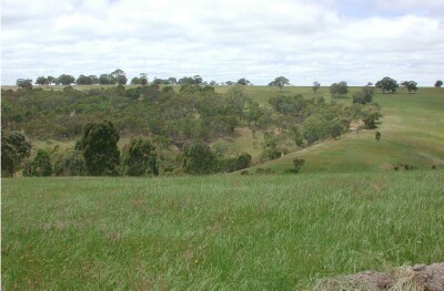 |
This site is the major soil type representing the Cambrian granite that is dissected by the Glenelg River and its tributaries. These soils are uniform in nature with relatively little clay throughout the profile. A common characteristic of these soils is a discontinuous cemented ironstone pan (petroferric horizon). Although the pan is discontinuous throughout this landscape, it does impact on the hydrological characteristics of the soil, decreasing the water holding capacity of the soil as well as acting as a barrier to plant roots. On the gentler slopes, there can be more soil development, with a common soil being Sodosols (GL160, GL122). The significant landscape feature of this land unit is the short steep slopes leading to the major drainage lines. The slope of the land, combined with the petroferric pan, are the major limitations for agriculture. |
Site Description:
| Geology: Cambrian granite | Landform pattern: V-shaped rolling valleys |
| Position in landscape: Lower slope | Internal drainage: Moderately well drained |
Soil Profile Morphology
| A1 | 0-15 cm | Brown (7.5YR4/4) loamy sand, loose structure, ferruginous nodules are common, pH 6.5. Transition to: |
| Subsoil | ||
| B2 | 15-45 cm | Dark brown (7.5YR3/4) clayey sand, loose structure, many ferruginous nodules forming a petroferric pan, pH 6.5. |
Key profile features:
- Petroferric pan
© State of Victoria (Agriculture Victoria) 1996 - 2025.

This work, Victorian Resources Online, is licensed under a Creative Commons Attribution 4.0 licence. You are free to re-use the work under that licence, on the condition that you credit the State of Victoria (Agriculture Victoria) as author, indicate if changes were made and comply with the other licence terms.
The licence does not apply to ‘branding’ or some ‘images or photographs’ that may be owned by third parties. We ask you to seek prior approval to use images using the VRO feedback form. Access to higher quality images can also be provided on request.
This page was last updated on 23/03/2020.