
GL35
Location: Dartmoor
Australian Soil Classification: Parapanic, Humosesquic, Semiaquic PODOSOL (confidence level 1)
General Landscape Description: Level plain
Site Description: Flat
Land Unit: Strathdownie
Geology: Quaternary lacustrine
General Land Unit Description: This land unit comprises the Quaternary lacustrine geology south of the Glenelg River. The lacustrine deposits include lagoonal, swamp and local colluvial deposits formed in low-lying wetlands and depressions between stranded beach ridges. Parent material in this land unit comprises of sand, silt, sandy clay, peat, marl and freshwater limestone, occurring in relatively unconsolidated forms.
The soils are variable throughout this land unit due to varying depositional environments. A common soil type is a strong texture contrast soil (Chromosol, Sodosol) commonly with a bleached A2 horizon and a mottled subsoil (indicative of impeded internal drainage). The sandy topsoil can be very deep in some soils. Vertosols are also common on the plains and swales in between the dunes. Podosols occur on the flats as well as on the dunes and that may have been mapped as part of this land unit due to restrictions of scale. Many of the soils are poorly drained and exhibit signs of a perched watertable.
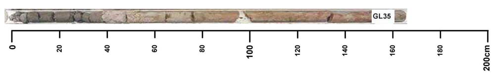
Key profile features:
- Deep sandy topsoil
- Bleached A2 horizon
- Ferruginous nodules above clay
- Mottled subsoil
- Sodic subsoil
Profile Described By: Natalie Baxter and Grant Boyle, 2nd October 2000.
© State of Victoria (Agriculture Victoria) 1996 - 2025.

This work, Victorian Resources Online, is licensed under a Creative Commons Attribution 4.0 licence. You are free to re-use the work under that licence, on the condition that you credit the State of Victoria (Agriculture Victoria) as author, indicate if changes were made and comply with the other licence terms.
The licence does not apply to ‘branding’ or some ‘images or photographs’ that may be owned by third parties. We ask you to seek prior approval to use images using the VRO feedback form. Access to higher quality images can also be provided on request.
This page was last updated on 23/03/2020.