
GL3
Location: Brimboal
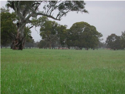
General Landscape Description: Level to gently undulating plain
Site Description: Flat
Land Unit: Dundas Redgum
Geology: Cainozoic duricrust
General Land Unit Description: The flat surface of the Dundas Tablelands predominantly consists of Brown Chromosols and to a lesser extent Yellow Chromosols with a ferric horizon, typically occurring above the clay subsoil. The soil is commonly developed over a highly weathered mottled zone. This red and white mottling, sometimes referred to as ‘tiger mottles’, is thought to be the result of deep chemical weathering which occurred during the late Tertiary period. Red gums are the dominant vegetation found on this surface.
Soil Profile Morphology
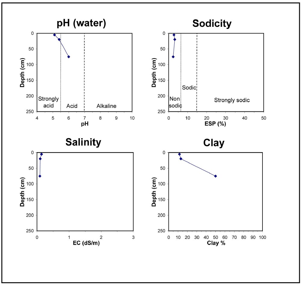
| A1 | 0-15 cm | Very dark greyish brown (10YR3/2); loam; weak ssubangular blocky structure; contains very few fine subrounded sedimentary pebbles; pH 5.1; gradual change to:
|
| A2 | 15-30 cm | Dark greyish brown (10YR4/2), bleached (10YR6/3d); sandy loam; weak subangular blocky structure; contains abundant small to medium ferruginised nodules are abundant; pH 5.4; clear change to:
|
| Subsoil
| ||
| B2 | 30-120 cm | Reddish yellow (7.5YR6/8), with many faint orange and red mottles; fine sandy light clay; moderate very fine subangular blocky structure; contains many angular sedimentary fragments; pH 6.0; clear change to:
|
| B3 | 120-200 cm | Yellowish red (5YR4/6) , with many fine prominent red and grey mottles; sandy clay loam; moderate fine subangular blocky structure; contains abundant angular sedimentary fragments. |
Key profile features:
- Strongly acidic topsoil
- Strong texture contrast between topsoil and subsoil
- Bleached A2 horizon
- Mottled subsoil
- Ferric horizon
Soil Profile Characteristics:
- | pH | Salinity | ||
Surface Soil (A1 horizon) | Strongly Acid | Medium | Non-Sodic | None |
Subsoil (15-25 cm) | Moderatly Acid | Very Low | Non-Sodic | None |
Chemical and Physical Analysis:
Horizon | Horizon Depth (cm) | pH (water) | pH (CaCl2) | EC dS/m | Exchangeable Aluminium ppm | Exchangeable Acididty meq/100g | Exchangeable Cations | Coarse Sand (0.2-2.0 mm) % | Fine Sand (0.02-0.2 mm) % | Silt (0.002-0.02 mm) % | Clay (<0.002 mm) % | Field Capacity % w/w | Wilting Point % w/w | |||
Ca | Mg | K | Na | |||||||||||||
meq/100g | ||||||||||||||||
A1 | 0-10 | 5.1 | 4.4 | 0.14 | 53 | 9.8 | 1.1 | 0.75 | 0.32 | 0.35 | 17 | 55 | 11 | 12 | 41.2 | 7.3 |
A2 | 10-30 | 5.4 | 4.7 | 0.10 | 31 | 7.1 | 0.89 | 0.74 | 0.22 | 0.30 | 20 | 54 | 9 | 13 | 45.5 | 5.5 |
B2 | 30-120 | 6.0 | 5.6 | 0.09 | <10 | 8.9 | 1.4 | 5.6 | 0.38 | 0.40 | 23 | 19 | 8 | 50 | 33.5 | 19.7 |
Profile Described By: Natalie Baxter and Grant Boyle, 1st October 2000.
© State of Victoria (Agriculture Victoria) 1996 - 2025.

This work, Victorian Resources Online, is licensed under a Creative Commons Attribution 4.0 licence. You are free to re-use the work under that licence, on the condition that you credit the State of Victoria (Agriculture Victoria) as author, indicate if changes were made and comply with the other licence terms.
The licence does not apply to ‘branding’ or some ‘images or photographs’ that may be owned by third parties. We ask you to seek prior approval to use images using the VRO feedback form. Access to higher quality images can also be provided on request.
This page was last updated on 23/03/2020.