
GL172b
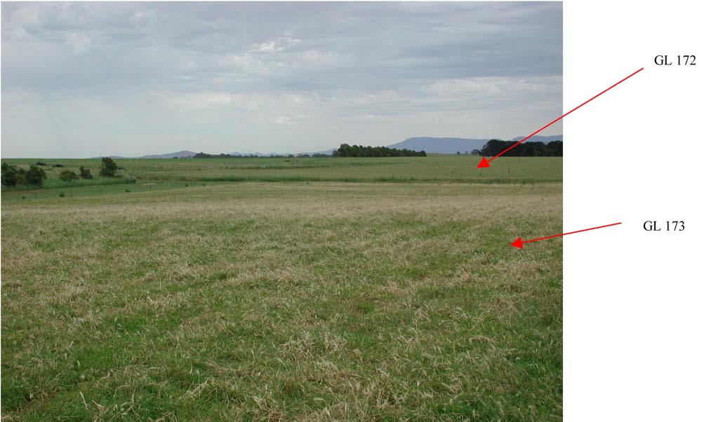
Location: Dobie
Australian Soil Classification: Vertic, Mottled-Mesonatric, Red SODOSOL (confidence level 1) (shallow soil depth)
General Landscape Description: Plain
Site Description: Mid-slope (2.5%)
Land Unit: Hillside Basalts
Geology: Quaternary basalt
General Land Unit Description: This land unit represents the gently undulating to undulating basalt plains around Ararat. The plains are often dissected with very slight rises. This site represents the lighter textured basalt soils on the slight rises, predominantly Red Sodosols. The soil indicates that there is some gilgai micro-relief although it is not that evident on the surface. Rock outcrops can occur, particularly on the crests of the small rises. Ferromanganiferous nodules can occur above the clayey subsoil. This often occurs as a thin band. The soils on the plains are commonly Brown Vertosols (GL173). There are commonly large cracks on the surface when the soil is dry and the soils themselves indicate significant movement.
Soil Profile Morphology:
| Surface Soil
| 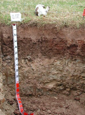 | ||
| A1 | 0-5 cm | Dark brown (10YR3/3); fine sandy clay loam, weak medium subangular blocky structure; weak consistence, dry; contains very few medium subrounded ferruginous and manganiferous nodules; pH(field) 5.0; clear change to:
| |
| A2 | 5-15 cm | Yellowish brown (10YR5/5),conspicuously bleached (10YR7/2d), with many distinct medium strong brown (10YR5/6) mottles; fine sandy clay loam,; massive structure; very weak consistence, dry; contains abundant medium subrounded ferruginised and manganiferous nodules; pH 5.8; abrupt and wavy change to: | |
| Subsoil
| |||
| B21 | 15-25 cm | Dark greyish brown (10YR4/2); common distinct slickensides evident; pH 6.9; changes to:
| |
| B22 | 45-55 cm | Dark yellowish brown (10YR4/4); changes to:
| |
| C | 55+ cm | Weathered basalt |
Key Profile Features:
- Strong texture contrast
- Strongly sodic top of subsoil
- Alkaline at depth
- Cracking subsoil
- Impeded internal drainage
- Bleached A2 horizon
- Ferromanganiferious nodules in A2 horizon
- Shallow soil
- Topsoil dispersive when worked when wet
- Subsoil dispersive when dry
Soil Profile Characteristics:
- | pH | Salinity | ||
Surface Soil (A2 horizon) | Moderately Acid | Low | Non-Sodic | None1 |
Subsoil (25-45 cm) | Slightly Alkaline | Low | Strongly Sodic | Complete |
Deeper Subsoil (45 -55 cm) | Strongly Alkaline | Low | Non-Sodic | Complete |
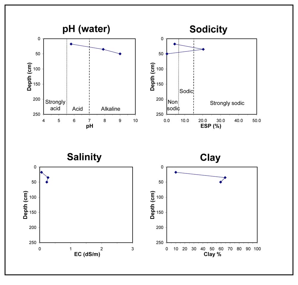
Chemical and Physical Analysis:
Horizon | Horizon Depth (cm) | pH (water) | pH (CaCl2) | EC dS/m | Organic Carbon % | Total Nitrogen % | Exchangeable Aluminium ppm | Exchangeable Acididty meq/100g | Exchangeable Cations | Coarse Sand (0.2-2.0 mm) % | Fine Sand (0.02-0.2 mm) % | Silt (0.002-0.02 mm) % | Clay (<0.002 mm) % | Field Capacity % w/w | Wilting Point % w/w | |||
Ca | Mg | K | Na | |||||||||||||||
meq/100g | ||||||||||||||||||
A1 | 0-5 | |||||||||||||||||
A2 | 15-25 | 5.8 | 4.6 | 0.06 | 0.74 | 0.07 | 16 | 5.5 | 1.7 | 0.83 | 0.31 | 0.39 | 15 | 50 | 23 | 10 | 19.3 | 8.8 |
B21 | 25-45 | 7.9 | 6.9 | 0.27 | 10 | 14 | 0.6 | 6.3 | 2 | 20 | 9 | 65 | 44.3 | 31.0 | ||||
B22 | 45-55 | 9.0 | 8.6 | 0.23 | 14 | 19 | 0.52 | 0.05 | 2 | 16 | 18 | 60 | 57.1 | 34.0 | ||||
C | 55 + | |||||||||||||||||
© State of Victoria (Agriculture Victoria) 1996 - 2025.

This work, Victorian Resources Online, is licensed under a Creative Commons Attribution 4.0 licence. You are free to re-use the work under that licence, on the condition that you credit the State of Victoria (Agriculture Victoria) as author, indicate if changes were made and comply with the other licence terms.
The licence does not apply to ‘branding’ or some ‘images or photographs’ that may be owned by third parties. We ask you to seek prior approval to use images using the VRO feedback form. Access to higher quality images can also be provided on request.
This page was last updated on 23/03/2020.