
Soil/Landform Unit 55
Landform Unit Description
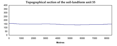
Page top
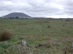 Looking across lava plains towards Mt Warrenheip with a blue stone quarry in the background |
0.08% of CMA region Within the Western Uplands are a number of swamps that are derived from a number of geological sources, the dominant being Quaternary lava plains and stony rises. These swamps and closed depressions host a wide variety of flora and fauna, many of which are protected species. Many of the swamps have been cleared and are used for grazing and cropping. Vegetation classes of these swamps include Plains Sedgy Wetland, Plains Grassy Wetland and Plains Grassy Woodland. Soils include the grey cracking clays on the lava plains, and black cracking clays associated with swamps and depressions of the stony rises. While waterlogging is the major limitation, soil compaction may also be a limitation to production without adequately controlled traffic. It should be noted that these swamps have been mapped due to their size with many other swamps identified as elements within alluvial plains. | 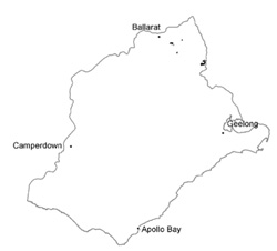 |
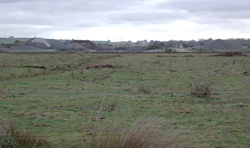 Some blue stone quarries occur in the ancient deep paleochennels | 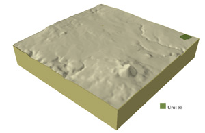 |
|
Component | 1 | 2 | 3 | 4 | 5 |
Proportion of soil-landform unit | 10% | 2% | 65% | 21% | 2% |
| CLIMATE Rainfall (mm) | Annual: 810 | ||||
| Temperature (oC) | Minimum 7, Maximum 17 | ||||
| Precipitation less than potential evapotranspiration | November-March | ||||
| GEOLOGY Age and lithology | Quaternary clay; sand and gravel and basalt | ||||
| Geomorphology | |||||
| LANDUSE | Uncleared: Nature conservation; water supply Cleared: Cropping (cereal); sheep and beef cattle grazing | ||||
| TOPOGRAPHY Landscape | Swamps and depressions in the north-east of the catchment | ||||
| Elevation range (m) | 409-569 | ||||
| Local relief (m) | 1-2 | ||||
| Drainage pattern | Deranged | ||||
| Drainage density (km/km2) | 1.9 | ||||
| Landform | Terraces | Swamp and depressions | Gently undulating plains | ||
| Landform element | Terrace 1 | Terrace 2 | Long gentle upper slopes | Depression | |
| Slope and range (%) | 1 (1-2) | 1 (1-2) | 1 (0-1) | 2 (1-3) | 1 (1-2) |
| Slope shape | Straight | Straight | Flat | Straight | Straight |
| NATIVE VEGETATION Structure | Plains Sedgy Wetland (1.3%), Plains Grassy Wetland (1.2%), Plains Grassy Woodland (0.7%) | ||||
| Dominant species | E. viminalis, E. radiata | E. viminalis, E. radiata | E. ovata | E. ovata, E. viminalis, E. rubida, E. obliqua | E. ovata, E. viminalis, E. rubida, E. obliqua |
| SOIL Parent material | Unconsolidated gravel, sand, silt and clay | Unconsolidated gravel, sand, silt and clay | Unconsolidated sands, silts and clays | In situ weathered rock | Basalt derived alluvium |
| Description (Corangamite Soil Group) | Dark brown soil - variable (34) | Yellow brown texture contrast soil (35) | Black cracking clay soil, coarse structure (39) | ||
| Soil type sites | |||||
| Surface texture | Fine sandy clay loam | Sandy clay loam | Light clay/clay | Clay loam | clay |
| Permeability | Moderate to low | Moderate to low | Low | Moderate to low | Moderate |
| Depth (m) | 2 | 2 | 2 | 1.5 | 1.5 |
| LAND CHARACTERISTICS, POTENTIAL AND LIMITATIONS | Low-lying areas receiving drainage are prone to waterlogging. Overland flow may result in streambank erosion and gully erosion where soils are exposed. | Low permeability, weak surface structure and hardsetting surfaces make soils vulnerable to gully and streambank erosion, and compaction. Overland flow salinity may occur through subsurface flow. | Slowly permeable soils lead to waterlogging and compactin. | Hardsetting surfaces, slowly permeable subsoils result in overland flow. Periodic waterlogging occurs along with compaction of surfaces and minor sheet erosion. | Clay soils beside creeks are highly susceptible to, waterlogging, Streambank undercutting and streambank erosion occur where soils are exposed. |
© State of Victoria (Agriculture Victoria) 1996 - .

This work, Victorian Resources Online, is licensed under a Creative Commons Attribution 4.0 licence. You are free to re-use the work under that licence, on the condition that you credit the State of Victoria (Agriculture Victoria) as author, indicate if changes were made and comply with the other licence terms.
The licence does not apply to ‘branding’ or some ‘images or photographs’ that may be owned by third parties. We ask you to seek prior approval to use images using the VRO feedback form. Access to higher quality images can also be provided on request.
This page was last updated on .