
Soil/Landform Unit 141
Landform Unit Description
Page top
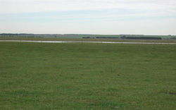 Depression and plains on the eastern margin of the lunette near Lake Durdeduke |
0.05% of CMA region A small depositional area developed from a swamp can be found to the west of Lake Murdeduke and north of Winchelsea. Basaltic plains (Unit 117) to the north and east, a lunette complex to the west (Unit 146) and alluvium to the south (Unit 156) surround this unit. The soils are grey and black cracking clays (Vertosols) that may be self-mulching. Remnant vegetation on these level plains has been cleared previously. Rainfall is moderate to low favouring cropping, particularly where friable organic rich surface soils exist. Site drainage is slow to very slow making the unit susceptible to waterlogging. The expansive clays generally require specific moisture conditions for maximum agricultural utility. | 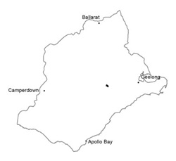 |
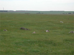 Basalt floaters | 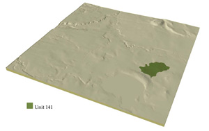 |
 | 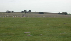 Slopes of unit 43 that boraders this unit and a swamp associated with Lake Murdeduke |
Component | 1 | 2 |
Proportion of soil-landform unit | 95 | 5% |
| CLIMATE Rainfall (mm) | Annual: 610 | |
| Temperature (oC) | Minimum 9, Maximum 19 | |
| Precipitation less than potential evapotranspiration | October-March | |
| GEOLOGY Age and lithology | Quaternary basalt and alluvium | |
| Geomorphology | ||
| LANDUSE | Cleared: Sheep and beef cattle grazing; cropping (cereal) | |
| TOPOGRAPHY Landscape | Level plains | |
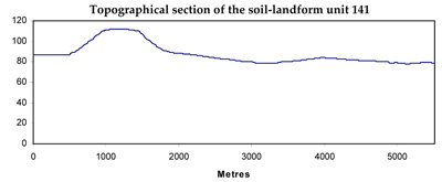
| Elevation range (m) | 77-88 | |
| Local relief (m) | 1-2 | |
| Drainage pattern | Dendritic | |
| Drainage density (km/km2) | 1.7 | |
| Landform | Plains | Open depressions |
| Landform element | ||
| Slope and range (%) | 0 (0-1) | 1 (0-2) |
| Slope shape | Straight | Concave |
| NATIVE VEGETATION Ecological Vegetation Class | Absent | |
| SOIL Parent material | Basaltic colluvium and alluvium | Basaltic colluvium and alluvium |
| Description (Corangamite Soil Group) | Grey cracking clays (31) | Grey cracking clays (31) |
| Soil type sites | SW97, MM75, CLRA15 | |
| Surface texture | Light clay | Medium clay |
| Permeability | Low | Very low |
| >2Depth (m) | >2 | >2 |
| LAND CHARACTERISTICS, POTENTIAL AND LIMITATIONS | Expansive clay soils with a high nutrient holding capacity. Poor site drainage may lead to waterlogging and compaction. | Expansive clay soils with a high nutrient holding capacity. Very poor site drainage of these soil types may lead to innundation, waterlogging and compaction. |
© State of Victoria (Agriculture Victoria) 1996 - .

This work, Victorian Resources Online, is licensed under a Creative Commons Attribution 4.0 licence. You are free to re-use the work under that licence, on the condition that you credit the State of Victoria (Agriculture Victoria) as author, indicate if changes were made and comply with the other licence terms.
The licence does not apply to ‘branding’ or some ‘images or photographs’ that may be owned by third parties. We ask you to seek prior approval to use images using the VRO feedback form. Access to higher quality images can also be provided on request.
This page was last updated on .