
Soil/Landform Unit 134
Landform Unit Description
Page top
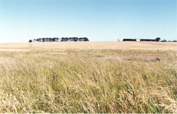 Undulating rises at Modewarre. While these slopes are long and gentle, many of the internal slopes of this landscape are short and have noticeable relief |
0.03% of CMA region The undulating rises near Moriac are composed chiefly of Quaternary basalt and alluvium. These rises are part of the deep regolith profiles that have developed on Quaternary volcanics across the Western Plains. Little remnant communities exist (less than 0.3%) including Plains Grassy Woodland and Grassy Woodland. These remnants are preserved mainly as roadside reserves. The rises have a number of elements that include gentle crests, mid slopes and lower slopes. Soils on these elements tend to be alkaline mottled black texture contrast soils, shallow black cracking clays and neutral and alkaline yellow texture contrast soils. Slopes have moderate to poor site drainage and restricted permeability. Soils tend to be strongly sodic with poor surface structure and therefore hardsetting when dry. Land use is mainly grazing with limited cropping. Minor soil salting and gully erosion may occur. | 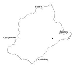 |
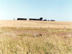 Grazing on these texture contrast rises is a common land use | 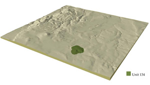 |
 |
Component | 1 | 2 | 3 |
Proportion of soil-landform unit | 30% | 40% | 30% |
| CLIMATE Rainfall (mm) | Annual: 640 | ||
| Temperature (oC) | Minimum 9, Maximum 19 | ||
| Precipitation less than potential evapotranspiration | October-April | ||
| GEOLOGY Age and lithology | Quaternary basalt and alluvium, Neogene fluvio-marine clay, sand and gravel | ||
| Geomorphology | |||
| LANDUSE | Uncleared areas: Nature conservation Cleared areas: Sheep and beef cattle grazing; cropping | ||
| TOPOGRAPHY Landscape | Undulating rises | ||
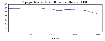
| Elevation range (m) | 87-124 | ||
| Local relief (m) | 20 | ||
| Drainage pattern | Dendritic | ||
| Drainage density (km/km2) | 1.5 | ||
| Landform | Gentle rise | ||
| Landform element | Gentle broad crest | Mid slope | Gentle lower slope |
| Slope and range (%) | 2 (1-5) | 3 (1-6) | 2 (0-3) |
| Slope shape | Convex | Straight | Straight |
| NATIVE VEGETATION Ecological Vegetation Class | Plains Grassy Woodland (0.2%), Grassy Woodland (0.1%) | ||
| SOIL Parent material | In situ basalt | In situ basalt | In situ basalt and colluvium |
| Description (Corangamite Soil Group) | Neutral and alkaline brown, grey or yellow texture contrast soils (37) | Neutral and alkaline brown, grey or yellow texture contrast soils (37) | |
| Soil type sites | |||
| Surface texture | Fine sandy clay loam, light clay | Fine sandy clay loam | Fine sandy clay loam |
| Permeability | Moderate to low | Moderate to low | Low |
| Depth (m) | <1 | <2 | <2 |
| LAND CHARACTERISTICS, POTENTIAL AND LIMITATIONS | Texture contrast; moderate nutrient holding capacity and water holding capacity (available water capacity) in upper soil. Heavy, often expansive clay subsoil, occasionally surface and subsoil. Soil depth from shallow (low available water capacity) to deep. Sodic, generally strongly, poor upper soil structure, hardsetting when dry. Moderate to poor site drainage, restricted permeability. | Texture contrast, moderate nutrient holding capacity and water holding capacity in upper soil. Heavy, often expansive clay subsoil, occasionally surface and subsoil. Soil depth from moderately deep, to deep. Sodic, generally strongly, poor upper soil structure, hardsetting when dry. Moderate to poor site drainage, restricted permeability. | Texture contrast, moderate nutrient holding capacity and water holding capacity in upper soil. Heavy, often expansive clay subsoil, occasionally surface and subsoil. Soil depth from moderately deep, to deep. Sodic, generally strongly, poor upper soil structure, hardsetting when dry. Poor site drainage with restricted permeability. |
© State of Victoria (Agriculture Victoria) 1996 - .

This work, Victorian Resources Online, is licensed under a Creative Commons Attribution 4.0 licence. You are free to re-use the work under that licence, on the condition that you credit the State of Victoria (Agriculture Victoria) as author, indicate if changes were made and comply with the other licence terms.
The licence does not apply to ‘branding’ or some ‘images or photographs’ that may be owned by third parties. We ask you to seek prior approval to use images using the VRO feedback form. Access to higher quality images can also be provided on request.
This page was last updated on .