
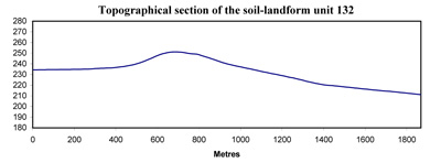
Soil/Landform Unit 132
Landform Unit Description
Page top
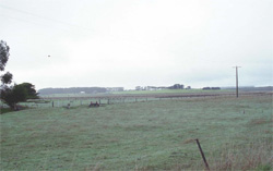 Looking north twoards the minor basalt rise near Pitfield |
0.02% of CMA region The undulating basalt rise near Pitfield has a well developed regolith profile within the Western Plains. This undulating rise may have some stone on the surface on the gentle crests and upper slopes. The soils are texture contrast with a shallow surface horizon over sodic medium to heavy clay subsoils. Poorly drained equivalents with conspicuous bleach are also found on slopes. Well structured red texture contrast soils are found on upper slopes and the crest. Local relief is less than 30 m with no developed drainage network. No significant vegetation has been observed on this rise. The land use is extensively cropping and grazing (mainly sheep). Land degradation issues include waterlogging and overland flow due to the low relief and sometimes hardsetting surfaces. |  |
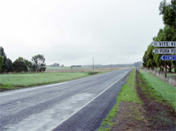 Surrounding plains at Pitfield | 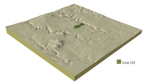 |
 |
Component | 1 | 2 |
Proportion of soil-landform unit | 65% | 35% |
| CLIMATE Rainfall (mm) | Annual: 620 | |
| Temperature (oC) | Minimum 8, Maximum 19 | |
| Precipitation less than potential evapotranspiration | October-March | |
| GEOLOGY Age and lithology | Quaternary basalt | |
| Geomorphology | ||
| LANDUSE | Cleared areas: Sheep grazing; cropping (cereal) | |
| TOPOGRAPHY Landscape | Undulating basalt rise | |
| Elevation range (m) | 203-255 | |
| Local relief (m) | 30 | |
| Drainage pattern | - | |
| Drainage density (km/km2) | - | |
| Landform | Undulating plains | |
| Landform element | Long gentle slopes | Plains |
| Slope and range (%) | 3 (1-5) | 1 (0-3) |
| Slope shape | Linear | Straight |
| NATIVE VEGETATION Ecological Vegetation Class | Absent | |
| SOIL Parent material | In situ weathered basalt | In situ weathered basalt |
| Description (Corangamite Soil Group) | Alkaline mottled yellow to brown texture contrast soils with poorly drained equivalents (36) | |
| Soil type sites | ||
| Surface texture | Fine sandy loam | Sandy loam |
| Permeability | Moderate | Low |
| Depth (m) | 1.5-2 | >2 |
| LAND CHARACTERISTICS, POTENTIAL AND LIMITATIONS | Hardsetting surfaces, dispersible subsoils and slow permeabiity results in overland flow and periodic waterlogging. Overland flow inadvertently causes sheet and rill erosion. | Hardsetting surfaces, dispersible subsoils and slow permeability results in overland flow and periodic waterlogging. Overland flow inadvertently causes sheet and rill erosion. |
© State of Victoria (Agriculture Victoria) 1996 - .

This work, Victorian Resources Online, is licensed under a Creative Commons Attribution 4.0 licence. You are free to re-use the work under that licence, on the condition that you credit the State of Victoria (Agriculture Victoria) as author, indicate if changes were made and comply with the other licence terms.
The licence does not apply to ‘branding’ or some ‘images or photographs’ that may be owned by third parties. We ask you to seek prior approval to use images using the VRO feedback form. Access to higher quality images can also be provided on request.
This page was last updated on .