
Soil/Landform Unit 109
Landform Unit Description
Page top
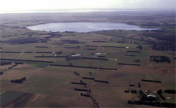 Lake Purrumbete is a rare example of a phreatomagmatic eruption point within the Western Plains of Victoria |
0.05% of CMA region This unit is a maar complex (Lake Purrumbete) within the volcanic Western Plains of the Corangamite region. This unit is a single unit and consists of low local relief (rise) that surrounds the phreatomagmatic eruption point of Lake Purrumbete. Moderately rapid site drainage combined with undulating slopes make these soils highly versatile. This maar complex exists between Camperdown and Pomborneit and is surrounded by undulating basalt plains (Unit 137) and stony rises (Unit 113). Remnant native vegetation of the maar includes Plains Grassy Woodland, Swamp Scrub and Stony Rises Herb-rich Woodland. The soils are deep friable red gradational and are mainly used for cropping and beef and dairy cattle grazing. These soils have a high nutrient holding capacity and inherent soil fertility. Soil compaction especially during wet seasons is a land management issue. | 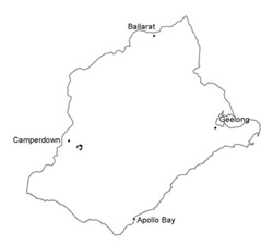 |
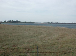 Crests and slopes are mainly used for grazing and cropping | 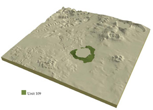 |
 | 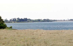 Waters of Lake Purrumbete |
Component | 1 | 2 |
Proportion of soil-landform unit | 20% | 80% |
| CLIMATE Rainfall (mm) | Annual: 760 | |
| Temperature (oC) | Minimum 8, Maximum 19 | |
| Precipitation less than potential evapotranspiration | October-March | |
| GEOLOGY Age and lithology | Quaternary scoria and minor basalt, Recent clay, sand and gravel | |
| Geomorphology | ||
| LANDUSE | Uncleared; Nature conservation; water supply; active and passive recreation Cleared: Dary farming; cropping; beef cattle and sheep grazing | |
| TOPOGRAPHY Landscape | Undulating rises | |
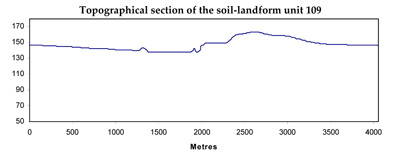
| Elevation range (m) | 138-173 | |
| Local relief (m) | 20 | |
| Drainage pattern | Radial | |
| Drainage density (km/km2) | 1.7 | |
| Landform | Rises associated with maar of Lake Purrumbete | |
| Landform element | Crests | Slopes |
| Slope and range (%) | 3 (1-6) | 5 (2-9) |
| Slope shape | Convex | Convex |
| NATIVE VEGETATION Ecological Vegetation Class | Plains Grassy Woodland (3.9%), Swamp Scrub (1.4%), Stony Rises Herb-rich Woodland (0.1%) | |
| SOIL Parent material | Scoria | Scoria and ash |
| Description (Corangamite Soil Group) | Friable red earths and loam soils (40) | Friable red earths and loam soils (40) |
| Soil type sites | ||
| Surface texture | Loam to clay loam | Loam to clay loam |
| Permeability | Moderate to high | High |
| Depth (m) | <1.5 | <2 |
| LAND CHARACTERISTICS, POTENTIAL AND LIMITATIONS | Friable, strongly structured, well drained soils with a high nutrient holding capacity. | Friable, strongly structured, well drained soils with a high nutrient holding capacity. |
© State of Victoria (Agriculture Victoria) 1996 - .

This work, Victorian Resources Online, is licensed under a Creative Commons Attribution 4.0 licence. You are free to re-use the work under that licence, on the condition that you credit the State of Victoria (Agriculture Victoria) as author, indicate if changes were made and comply with the other licence terms.
The licence does not apply to ‘branding’ or some ‘images or photographs’ that may be owned by third parties. We ask you to seek prior approval to use images using the VRO feedback form. Access to higher quality images can also be provided on request.
This page was last updated on .