
40 Red and black strongly structured gradational and uniform soils (earths and loams) on Quaternary basic volcanics
| These soils occur on basic volcanic deposits in well drained areas and positions, such as eruption points and associated scoria and ash deposits in both the south-west of the CMA and east of Ballarat in the Western Uplands, as well as scattered occurrences on the basaltic volcanic plains including many stony rises. These soils are strongly (moderate and fine) structured throughout with dark friable clay loam to light clay surface soils (10–50 cm depth) grading into dark or red clay loam to medium clays, which generally grade into the parent material at well over 100 cm (BD5, SW26) or may be shallower on stony terrain (SW96) at about 40–60 cm. Notable characteristics include: the gradational increase in clay content with depth, high clay content, strong fine structure (high pedality), slightly acidic to neutral pH, high free iron content, and high nutrient levels. | 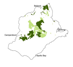 |
Soil Sites
Site Code | Soil-landform unit | Component | ASC | FK | 1:100 000 mapsheet |
| Mid slope | Melanic, Eutrophic, Red Ferrosol | Gn4.12 | T7622 - Ballarat | ||
| Simple slope | Haplic, Eutrophic, Red Ferrosol | Gn4.12 | T7622 - Ballarat | ||
| Simple slope | Melanic, Eutrophic, Red Ferrosol | Fn4.12 | T7622 - Ballarat | ||
| Crest | Melanic, Eutrophic, Red Ferrosol | Gn4.12 | T7622 - Ballarat | ||
| Lower slope | Sodic, Eutrohpic, Brown Dermosol (Ferrosol?) | Gn3.22 | T7621 - Colac | ||
| Plain | Humose, Calcic, Black Dermosol (Ferrosol?) | Gn3.43 | T7521 - Corangamite | ||
| Upper slope | Vertic (& Sodic), Calcic, Black Dermosol | Gn3.43 | T7721 - Geelong | ||
SW97 | Simple slope | Vertic (& Sodic), Calcic, Black Dermosol | Gn3.43, Gn3.93 | T7721 - Geelong |
© State of Victoria (Agriculture Victoria) 1996 - .

This work, Victorian Resources Online, is licensed under a Creative Commons Attribution 4.0 licence. You are free to re-use the work under that licence, on the condition that you credit the State of Victoria (Agriculture Victoria) as author, indicate if changes were made and comply with the other licence terms.
The licence does not apply to ‘branding’ or some ‘images or photographs’ that may be owned by third parties. We ask you to seek prior approval to use images using the VRO feedback form. Access to higher quality images can also be provided on request.
This page was last updated on .