
3.3.3 Alluvial terraces and floodplains associated with Dissected low hills of the Southern Uplands
|
Alluvial flats and alluvial terraces have formed in the wide valley floors at the base of the rolling hills. The wide floodplain of the Barwon River from Gerangamete to Birregurra has developed in response to the changes in base levels associated with the periodic damming of the river by Newer Volcanic basalt flows around Winchelsea and the fluctuating sea levels of the Quaternary. | 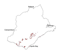 |
Soil-landform unit | Original unit ID | Unit description | Area (km2) |
| Carlisle L.S. | Elevated dissected terraces (Gellibrand River) | 25 | |
| Barwon River L.S. | Floodplain (Barwon River and tributaries) | 57 | |
| Gellibrand River L.S. | Floodplain (Gellibrand, Aire and Barham rivers) | 42 | |
| Point Roadknight L.S. | Longitudinal coastal dunes | 7 |
© State of Victoria (Agriculture Victoria) 1996 - .

This work, Victorian Resources Online, is licensed under a Creative Commons Attribution 4.0 licence. You are free to re-use the work under that licence, on the condition that you credit the State of Victoria (Agriculture Victoria) as author, indicate if changes were made and comply with the other licence terms.
The licence does not apply to ‘branding’ or some ‘images or photographs’ that may be owned by third parties. We ask you to seek prior approval to use images using the VRO feedback form. Access to higher quality images can also be provided on request.
This page was last updated on .