
Wandin Yallock Creek
To view the information PDF requires the use of a PDF reader. This can be installed for free from the Adobe website (external link).
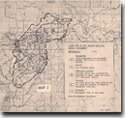
Land Systems in the Wandin Yallock Creek Catchment
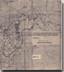
Location of Watercourse Cross-Sections in the Wandin Yallock Creek Catchment
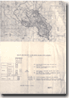
Geology and Structure in the Wandin Yallock Creek Catchment
Page top
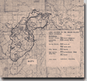
Land Use in the Wandin Yallock Creek Catchment
 | (PDF 338KB) |
Land Systems in the Wandin Yallock Creek Catchment
 | (PDF 331KB) |
Location of Watercourse Cross-Sections in the Wandin Yallock Creek Catchment
 | (PDF 301KB) |
Geology and Structure in the Wandin Yallock Creek Catchment
 | (PDF 255KB) |

© State of Victoria (Agriculture Victoria) 1996 - .

This work, Victorian Resources Online, is licensed under a Creative Commons Attribution 4.0 licence. You are free to re-use the work under that licence, on the condition that you credit the State of Victoria (Agriculture Victoria) as author, indicate if changes were made and comply with the other licence terms.
The licence does not apply to ‘branding’ or some ‘images or photographs’ that may be owned by third parties. We ask you to seek prior approval to use images using the VRO feedback form. Access to higher quality images can also be provided on request.
This page was last updated on .