
Site 17 Black Eagle Water Reserve
Site appears to be in a stable environmental condition
Description
This site was a historic water reserve and is now an area reserved for public recreation. The site is at an elevation of 285 metres, adjacent to Axe Creek and subject to periodic flooding. The site is in a low-lying area and surrounded by sedimentary hills.
Vegetation Description and Composition This Riparian Woodland is dominated by an Eucalyptus camaldulensis (Red Gum) overstorey with scattered Acacia mearnsii (Black Wattles) and an understorey of Sedges, Rushes, native and introduced grasses. The EVC represented is Creekline Grassy Woodland, endangered within the Goldfields Bioregion. The native understorey is being replaced by introduced species. Now more than 60% of the total species are introduced compared with 50% of the total species in 1997. The continued dry conditions may have led to the increase in abundance of introduced grasses and a decrease in level of abundance of Cirsium vulgare (Spear Thistle). In 2001 the invasive grass Phalaris spp. was observed within the Quadrat. This plant has the potential to dominate the herb layer of the site if left unchecked. | 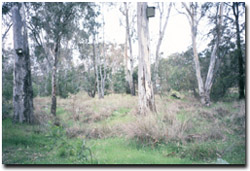 The Axe Creek Landcare group erected nesting boxes at the site in 1998 |
Tree Health
Four trees are monitored for tree canopy health using a 20-point system assessing canopy size and density, number of dead branches and extent of epicormic growth. Leaf damage by insects is also assessed. The four Eucalyptus camaldulensis (Red Gum) trees have experienced some decline in health since 1996 due to reduced canopy densities and level of epicormic growth. They also appear to be suffering moderate amounts of insect attack from lerps. The health scores are still indicating fairly reasonable tree health and are of no concern at the moment.
Groundwater and Salinity
Two bores are located at the site and the groundwater levels fluctuate in response to local seasonal and climatic variation. Since monitoring commenced in 1996, water tables have fallen to around 3.5 m below natural surface in response to the dry seasonal conditions. Salinity readings recorded in 2002 were >5 000 EC (extremely saline water) and a threat to the site if water tables were to rise when wet conditions return.
Birds
Bird species present at the time of the vegetation and tree health surveys were :-
Black-faced Cuckoo-shrike, Crested Pigeon, Crimson Rosella, Grey Shrike-thrush, Crested Shrike-tit, Magpie, Spotted Pardalote, Striated Pardalote, Superb Fairy-wren White-plumed Honeyeater, Corella, Galah, Australian Raven, Little Raven, Australian Magpie, Red Wattlebird, Willie Wagtail and Yellow Rumped Thornbill.
Threats to the site continue to be:
- Continued weed invasion and spread of Phalaris spp.
- grazing by rabbits.
- trampling by people from adjacent picnic facility and people checking nest boxes.
- erosion of adjacent bank only several metres from the Quadrat.
© State of Victoria (Agriculture Victoria) 1996 - 2025.

This work, Victorian Resources Online, is licensed under a Creative Commons Attribution 4.0 licence. You are free to re-use the work under that licence, on the condition that you credit the State of Victoria (Agriculture Victoria) as author, indicate if changes were made and comply with the other licence terms.
The licence does not apply to ‘branding’ or some ‘images or photographs’ that may be owned by third parties. We ask you to seek prior approval to use images using the VRO feedback form. Access to higher quality images can also be provided on request.
This page was last updated on 23/03/2020.