
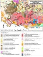
Geomorphology
See also Victoria's Geomorphological Framework
The Glenelg Hopkins region of south-west Victoria covers approximately 2.5 million hectares. It extends from Ballarat in the east, to the South Australian border in the west, and from the upland towns of Ararat and Harrow down to the coast of western Bass Strait. |
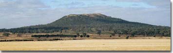
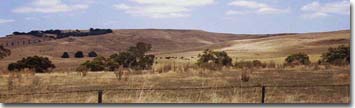
 View of the volcanic plains landscape from Mt Noorat. | 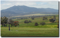 Mt Langi Ghiran. |
|
|
© State of Victoria (Agriculture Victoria) 1996 - 2025.

This work, Victorian Resources Online, is licensed under a Creative Commons Attribution 4.0 licence. You are free to re-use the work under that licence, on the condition that you credit the State of Victoria (Agriculture Victoria) as author, indicate if changes were made and comply with the other licence terms.
The licence does not apply to ‘branding’ or some ‘images or photographs’ that may be owned by third parties. We ask you to seek prior approval to use images using the VRO feedback form. Access to higher quality images can also be provided on request.
This page was last updated on 23/03/2020.