
2.3.2 Low relief, low drainage density (Eastern Dundas Tableland - Brimpaen)
|
Occurrences of the Eastern Dundas Tableland within the WCMA region include plains between Cherrypool and Brimpaen along with gently undulating plains at Telangatuk East. The plains fall either side of the western Black Range and as such represent part of a once expansive Neogene plain. | 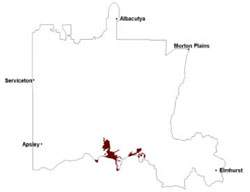 |
Soils are similar to those on the high relief low density tableland (2.3.1) being gradational through to texture contrast soils with sandy surfaces and heavy subsoils (Dermosols, Chromosols). Ferricrete and ferruginous segregations (buckshot) are common as is the distinctive red and pale grey ‘tiger mottling’ that is representative of these Neogene regolith profiles. Grey (occasionally brown and black) cracking clays (Vertosols) may also occur in the depressions and on level plains.
Wetlands of these plains that also supply water to the Rocklands Reservoir occur south of Brimpaen. Savannah wetlands that are subject to periodic waterlogging seasonally provide habitats to many forms of fauna. Salinity is also a major issue (where exposed in drainage depressions often as discharge sites) with highly acidic conditions resulting in precipitation of acid sulphate minerals.
Soil-landform unit | Unit description | Area (km2) |
| Balmoral undulating plain | Deeply dissected valley | 32 |
| Brimpaen undulating plain | Undulating plain | 56 |
| Grampians outwash slopes | Lower outwash slopes | 14 |
| Telangatuk plains | Flat plain | 132 |
© State of Victoria (Agriculture Victoria) 1996 - .

This work, Victorian Resources Online, is licensed under a Creative Commons Attribution 4.0 licence. You are free to re-use the work under that licence, on the condition that you credit the State of Victoria (Agriculture Victoria) as author, indicate if changes were made and comply with the other licence terms.
The licence does not apply to ‘branding’ or some ‘images or photographs’ that may be owned by third parties. We ask you to seek prior approval to use images using the VRO feedback form. Access to higher quality images can also be provided on request.
This page was last updated on .